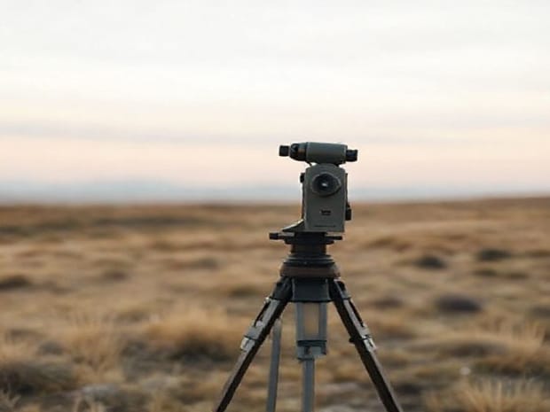
How To Use A Theodolite To Measure Distance
Using a theodolite to measure distance is a fundamental skill in surveying and civil engineering. Theodolites are precision instruments designed to measure horizontal and vertical angles with high accuracy, and when combined with trigonometric calculations, they can be used to determine distances between points that are difficult to access directly. Learning how to use a theodolite to measure distance allows engineers, surveyors, and students to conduct accurate measurements for construction projects, land mapping, and research purposes. Proper handling, calibration, and understanding of the principles behind theodolite measurements are crucial for achieving precise results.
Understanding the Theodolite
A theodolite is an optical instrument mounted on a tripod, equipped with a rotating telescope, graduated circles, and leveling screws. It measures angles in both horizontal and vertical planes. Modern theodolites may include digital displays and electronic distance measurement (EDM) features, while traditional theodolites require manual readings. The device is essential in triangulation, establishing boundaries, and mapping topographical features.
Main Components
- TelescopeRotates vertically and horizontally to sight the target.
- Horizontal CircleGraduated circle for measuring horizontal angles.
- Vertical CircleGraduated circle for measuring vertical angles.
- Leveling ScrewsUsed to ensure the instrument is perfectly horizontal.
- TripodProvides a stable base for accurate measurements.
Preparing the Theodolite
Before taking measurements, the theodolite must be properly set up and calibrated. Follow these steps to ensure accuracy
Step 1 Set Up the Tripod
- Place the tripod over the survey point and extend the legs to a comfortable working height.
- Ensure the tripod is roughly level and stable on the ground.
- Tighten the leg screws to prevent movement during measurement.
Step 2 Mount the Theodolite
- Attach the theodolite securely to the tripod head.
- Use the leveling screws to adjust the instrument until the bubble in the spirit level is centered.
- Check that the instrument is stable and the telescope can rotate freely.
Step 3 Calibrate the Theodolite
Calibration ensures that angle readings are accurate. Align the telescope with a known reference point, and verify the zero reading on the horizontal and vertical circles. Repeat if necessary until the instrument shows consistent readings.
Measuring Distance Using a Theodolite
Distance measurement using a theodolite relies on the principle of trigonometry. By measuring the horizontal angle, vertical angle, and optionally the baseline distance, you can calculate the distance to an inaccessible point. There are two common methods the stadia method and trigonometric leveling.
Stadia Method
The stadia method uses the crosshairs in the theodolite’s telescope to measure a rod or staff held at the target point. Follow these steps
- Sight the telescope on the target rod.
- Read the top and bottom stadia hairs where they intersect the rod’s markings.
- Subtract the lower reading from the upper reading to find the stadia interval.
- Multiply the stadia interval by the stadia constant (usually 100) to calculate the horizontal distance.
Trigonometric Method
The trigonometric method involves measuring vertical and horizontal angles to determine distances indirectly. Follow these steps
- Measure the horizontal angle between the survey point and the target.
- Measure the vertical angle of elevation or depression to the target.
- Determine the height difference between the instrument and the target, if known.
- Apply trigonometric formulas distance = height difference ÷ tan(vertical angle) for simple cases, or use more complex formulas for oblique angles and sloped terrain.
Tips for Accurate Distance Measurement
Accuracy in using a theodolite depends on careful handling and attention to detail. Consider the following tips
- Ensure the theodolite is perfectly leveled before each measurement.
- Minimize vibrations and wind interference by stabilizing the tripod and working carefully.
- Double-check angle readings and repeat measurements for consistency.
- Keep a record of all readings and calculations to verify results later.
- Use a clear line of sight between the instrument and the target to reduce error.
Common Mistakes to Avoid
Even experienced surveyors can make mistakes if they overlook small details. Avoid these common errors
- Improper leveling of the instrument, leading to inaccurate angles.
- Misreading stadia rod markings or ignoring minor parallax errors.
- Not accounting for height differences between the instrument and target.
- Failing to recalibrate the theodolite after moving it to a new location.
- Relying on a single measurement without verification.
Applications of Distance Measurement with a Theodolite
Knowing how to use a theodolite to measure distance is essential in various fields
- SurveyingMapping land boundaries and creating topographic maps.
- ConstructionDetermining distances for building layouts and infrastructure planning.
- Engineering ProjectsMeasuring slopes, heights, and distances for bridges, roads, and tunnels.
- ResearchStudying geological features and environmental changes.
Mastering how to use a theodolite to measure distance requires a combination of technical knowledge, careful setup, and attention to detail. By understanding the instrument’s components, preparing it properly, and applying methods such as the stadia or trigonometric techniques, accurate distance measurements can be achieved even in difficult terrain. Practicing these methods and double-checking readings ensures reliable results for surveying, construction, and research projects. With patience and precision, using a theodolite becomes an indispensable skill for professionals and students in fields that rely on accurate spatial measurements.