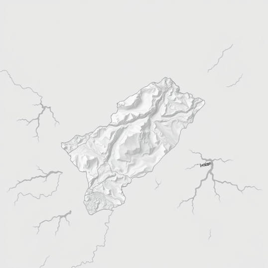
How Is The Physiography Of Uttarakhand
Uttarakhand, located in the northern part of India, is a state renowned for its diverse and striking physiography, which ranges from snow-capped peaks to fertile plains. The physical landscape of Uttarakhand plays a crucial role in determining its climate, vegetation, agriculture, and settlement patterns. Its physiography is shaped by the Himalayan mountain system, river networks, and geological formations that have developed over millions of years. Understanding the physiography of Uttarakhand is essential for appreciating its natural beauty, ecological diversity, and the challenges associated with development and natural hazards in the region.
Geographical Location of Uttarakhand
Uttarakhand is strategically situated in the northwestern part of India, bordered by Tibet (China) to the north, Nepal to the east, Himachal Pradesh to the west, and the plains of Uttar Pradesh to the south. Covering an area of approximately 53,483 square kilometers, the state is divided into two main divisions Garhwal in the west and Kumaon in the east. The varying altitudes and latitudes across these regions contribute to the state’s complex physiography, which includes mountains, valleys, plateaus, and river plains.
Topographical Divisions
- High Himalayas (Greater Himalayas) – The northernmost and highest part of the state, featuring peaks exceeding 7,000 meters.
- Middle Himalayas (Lesser Himalayas) – Rugged mountains and hill ranges forming the central portion of the state.
- Shivalik Hills (Outer Himalayas) – Lower ranges at the southern edge of the Himalayas, characterized by gentle slopes and sedimentary deposits.
- Terai and Bhabar Plains – Fertile plains at the southern foothills, ideal for agriculture and settlement.
The Himalayan Region
The physiography of Uttarakhand is dominated by the Himalayan mountain system, which is subdivided into three major ranges the Greater Himalayas, the Lesser Himalayas, and the Shivalik Hills. The Greater Himalayas, or the Himadri, include some of the highest peaks in the world, such as Nanda Devi, Kamet, and Trisul. These high-altitude areas are mostly covered by glaciers, snowfields, and alpine vegetation. The region is sparsely populated due to extreme climatic conditions and rugged terrain.
Glacial and Mountain Features
- Glaciers – The Gangotri and Pindari glaciers are prominent, feeding major rivers in the state.
- Mountain Peaks – Several peaks rise above 6,000 meters, providing spectacular landscapes and acting as watershed areas.
- Valleys – Glacial valleys such as the Bhilangna and Yamunotri valleys are narrow and steep-sided, often inaccessible except by trekking routes.
Lesser Himalayas and Hill Regions
The Lesser Himalayas, also known as the Middle Himalayas or Himachal, feature rugged terrain with steep slopes, deep valleys, and hill ranges such as the Almora and Mussoorie hills. These areas are heavily forested and support a variety of wildlife and vegetation, including coniferous and broadleaf forests. The climate in this region is milder compared to the Greater Himalayas, making it suitable for human habitation, agriculture, and tourism activities.
Important Features of the Lesser Himalayas
- Hill Stations – Popular destinations like Nainital, Mussoorie, and Ranikhet are located in this region due to favorable climate and accessibility.
- River Valleys – Major rivers such as the Alaknanda and Mandakini carve deep valleys, providing fertile land along their banks.
- Forests and Biodiversity – The region hosts diverse flora and fauna, including oak, pine, and rhododendron forests.
Shivalik Hills and Foothill Plains
The Shivalik Hills, forming the outermost ranges of the Himalayas, consist of softer sedimentary rocks and are generally lower in altitude compared to the central and high Himalayas. These hills are followed by the Terai and Bhabar plains, which are fertile and densely populated. The Terai region features marshy grasslands and dense vegetation, while the Bhabar area has coarser soil and is relatively drier.
Characteristics of the Shivalik and Terai Region
- Gentle Slopes – The terrain is less steep than the central Himalayas, making it more suitable for agriculture and urban settlements.
- Rich Soil – Fertile alluvial deposits support intensive cultivation of crops such as wheat, rice, and sugarcane.
- Water Availability – Numerous rivers and streams originating from the higher Himalayas provide water for irrigation and domestic use.
River Systems of Uttarakhand
Rivers play a vital role in shaping the physiography of Uttarakhand. The state is a major watershed of the Ganges and Yamuna river systems, with rivers originating from glaciers and snowfields in the Greater Himalayas. These rivers flow through valleys, carving deep gorges, and depositing alluvial soil in the plains. Key rivers include the Ganga, Yamuna, Alaknanda, Bhagirathi, and Mandakini. River valleys influence settlement patterns, agriculture, and transport routes in the state.
River Features
- Gorges and Canyons – Steep valleys such as the Alaknanda gorge demonstrate the erosive power of Himalayan rivers.
- Floodplains – Fertile areas along the Ganga and Yamuna support intensive farming and human settlements.
- Hydropower Potential – The steep gradients of Himalayan rivers are utilized for hydroelectric projects.
Climatic Influence on Physiography
The physiography of Uttarakhand influences its climate, which varies from alpine in the high mountains to subtropical in the foothills. Altitude and slope orientation determine temperature, precipitation, and vegetation patterns. Higher altitudes experience snow and harsh winters, while lower regions receive heavy monsoon rainfall. The variation in climate across different physiographic zones supports diverse ecosystems and agricultural practices.
Impact on Agriculture and Settlement
- High Himalayas – Limited agriculture, mostly pastoral activities due to extreme climate.
- Lesser Himalayas – Terraced farming of rice, wheat, and horticultural crops.
- Shivalik and Terai – Intensive agriculture due to fertile plains and adequate water supply.
The physiography of Uttarakhand is a complex interplay of mountains, hills, plains, and river systems that define its natural beauty, ecological diversity, and human settlement patterns. From the towering peaks of the Greater Himalayas to the fertile Terai plains, the state exhibits a range of landforms shaped by geological and climatic processes over millions of years. The river systems originating from glaciers and high mountains not only influence the terrain but also support agriculture, settlements, and hydroelectric development. Understanding the physiography of Uttarakhand is crucial for environmental planning, disaster management, and sustainable development in this ecologically sensitive and geographically diverse region.
Overall, Uttarakhand’s physiography demonstrates the diversity and grandeur of the Himalayan landscape. The state’s mountains, valleys, hills, and plains create a mosaic of environments that support a wide variety of flora, fauna, and human activities. By studying its physiography, one can appreciate the natural forces that continue to shape Uttarakhand’s land, offering insights into its geology, hydrology, climate, and cultural significance.