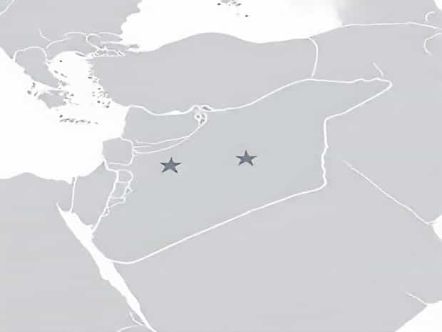
Map Of Syria And Surrounding Countries
Syria is a country located in the heart of the Middle East, sharing borders with several nations and occupying a strategically important position. Understanding Syria’s map and its surrounding countries is essential for grasping its geopolitical, cultural, and economic significance. The country’s location has historically made it a crossroads of civilizations, trade routes, and conflicts. Studying the map of Syria in relation to neighboring countries helps provide context for regional politics, trade, migration, and cultural interactions, offering insights into both historical and contemporary developments.
Geographical Location of Syria
Syria is situated in Western Asia, bordering the eastern Mediterranean Sea. It covers an area of approximately 185,000 square kilometers, making it a moderately sized country in the region. Syria’s terrain is diverse, including coastal plains along the Mediterranean, fertile river valleys, mountainous regions, and desert areas in the east and south. This varied geography influences climate, population distribution, and economic activities, such as agriculture, industry, and trade.
Neighboring Countries
Syria shares land borders with five countries Turkey to the north, Iraq to the east, Jordan to the south, Israel to the southwest, and Lebanon to the west. Each neighboring country has its own historical and cultural ties with Syria, and these borders play crucial roles in political relations, security, and economic exchanges. For instance, the Syrian-Turkish border is significant for trade and migration, while the border with Iraq has been historically important for oil transport and regional connectivity.
Bordering Turkey
To the north, Syria shares a lengthy border with Turkey that stretches approximately 822 kilometers. This border crosses several provinces, including Aleppo and Idlib in Syria and Gaziantep and Hatay in Turkey. Historically, the northern border has been a site of cultural exchange, trade, and, more recently, migration due to regional conflicts. The border region features a mix of urban centers, agricultural land, and mountainous terrain, making it strategically significant for both countries.
Bordering Iraq
On its eastern side, Syria borders Iraq, with a boundary of about 605 kilometers. The eastern border traverses desert regions and sparsely populated areas, which historically facilitated the movement of nomadic groups and trade caravans. Today, the Syria-Iraq border is critical for trade, energy transport, and security concerns. Rivers such as the Euphrates flow through this region, providing water resources for agriculture and human settlements. The desert terrain along this border presents challenges for infrastructure development and border security.
Bordering Jordan
The southern border of Syria with Jordan extends approximately 375 kilometers. This area is characterized by desert and semi-arid landscapes, with limited population density. The border region is strategically important for controlling trade routes and migration flows. Historically, trade caravans traveled through this area, connecting Syria with the Arabian Peninsula. Today, the border remains significant for cross-border trade, tourism, and managing refugee movements from Syria.
Bordering Israel
To the southwest, Syria shares a short border of about 76 kilometers with Israel. This border area includes the Golan Heights, a region of political and strategic importance due to its elevation and water resources. The Golan Heights has been a point of conflict and negotiation, influencing Syria-Israel relations. The border is monitored closely, and access is limited, making it a highly sensitive geopolitical zone. Understanding the map of Syria and the location of the Golan Heights is essential for analyzing regional security issues.
Bordering Lebanon
On the western side, Syria shares a border of about 375 kilometers with Lebanon. This border runs along the Anti-Lebanon Mountains and provides significant cultural, economic, and political interactions between the two countries. The proximity of Syrian and Lebanese communities has facilitated trade, migration, and family ties over centuries. Major cities in Syria near the Lebanese border include Damascus and Homs, while Lebanon’s border towns such as Baalbek and Tripoli maintain economic connections with Syria. This border region is also important for energy transport and infrastructure projects.
Internal Geography and Major Cities
Studying a map of Syria also reveals the location of key cities, rivers, and geographical features that define the country. Damascus, the capital, is located in the southwestern part of Syria, near the border with Lebanon, and serves as the political and cultural center. Aleppo, in the north, has historically been a major trade and industrial hub. Other important cities include Homs, Hama, Latakia, and Deir ez-Zor. Rivers such as the Euphrates and Orontes provide essential water resources for agriculture, industry, and human settlements. The western coastal region along the Mediterranean is fertile and densely populated, contrasting with the arid eastern desert regions.
Rivers and Natural Features
The Euphrates River is Syria’s longest and most significant river, flowing from Turkey into Syria and continuing into Iraq. It supports agriculture, hydroelectric power, and settlements along its banks. Other rivers, such as the Orontes and the Barada, provide water for cities and farming areas. Syria’s mountain ranges, including the Anti-Lebanon Mountains and Jabal al-Druze, influence climate patterns and create natural barriers that affect settlement distribution and military strategy. The Syrian Desert in the east covers vast areas with sparse population, emphasizing the contrast between fertile and arid zones.
Strategic Importance of Syria’s Location
Understanding the map of Syria and its surrounding countries highlights the nation’s strategic significance in the Middle East. Its central location connects the Mediterranean with inland Asia, making it a historical trade route and cultural crossroads. Control of borders, access to water resources, and proximity to major regional powers influence Syria’s political, economic, and security dynamics. The diversity of terrain, including mountains, rivers, and deserts, also plays a role in defense strategies and urban planning.
Regional Connectivity
Syria’s map reveals major highways, trade routes, and border crossings that link it with Turkey, Iraq, Jordan, Israel, and Lebanon. These routes facilitate trade, tourism, and cultural exchanges, while also posing challenges for security and border management. The country’s location on key regional corridors underscores its importance in geopolitics, energy transport, and international relations. Understanding the map helps in analyzing regional conflicts, migration patterns, and economic integration.
The map of Syria and its surrounding countries provides a comprehensive view of the nation’s geography, borders, and strategic position. Syria’s location in the Middle East, bordering Turkey, Iraq, Jordan, Israel, and Lebanon, shapes its political, economic, and cultural significance. Its diverse terrain, including fertile river valleys, mountains, and deserts, supports urban centers, agriculture, and trade. Studying Syria’s map helps understand regional connectivity, border dynamics, and the historical and contemporary importance of this pivotal country. By examining its geographical context, one can gain a clearer picture of Syria’s role in regional and global affairs.