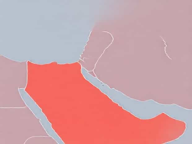
Map Of Middle East
The Middle East is a region of immense historical, cultural, and geopolitical significance, stretching across parts of Western Asia and North Africa. It has been the cradle of some of the world’s earliest civilizations, including Mesopotamia, Ancient Egypt, and the Persian Empire. Understanding a map of the Middle East is essential for anyone looking to grasp the region’s complex geography, strategic locations, natural resources, and political boundaries. A detailed map highlights the diversity of landscapes, from deserts and mountains to fertile river valleys, and helps explain how geography has influenced trade, migration, and cultural development throughout history.
Geographic Boundaries of the Middle East
The Middle East is generally defined as the area encompassing countries such as Saudi Arabia, Iran, Iraq, Israel, Jordan, Lebanon, Syria, Turkey, United Arab Emirates, Oman, Qatar, Bahrain, and Kuwait, with Egypt often included due to its connection via the Sinai Peninsula. The region is bounded by the Mediterranean Sea to the west, the Persian Gulf to the east, the Red Sea to the southwest, and the Arabian Sea to the south. A map of the Middle East clearly delineates these boundaries, providing a visual context for the region’s geography, its strategic location between Europe, Africa, and Asia, and its access to crucial waterways.
Major Cities in the Middle East
Maps of the Middle East highlight key urban centers that serve as political, economic, and cultural hubs. Cities like Riyadh, Tehran, Baghdad, Jerusalem, Istanbul, Cairo, and Dubai are essential markers on any map. These cities have historically been centers of governance, trade, and culture, and their location relative to rivers, seas, and trade routes demonstrates the interplay between geography and urban development. Understanding these cities on a map helps contextualize population distribution, economic activity, and historical significance across the Middle East.
- Riyadh, Saudi Arabia – the political and administrative capital.
- Tehran, Iran – a major cultural and economic hub in the region.
- Baghdad, Iraq – historically a center of learning and trade.
- Jerusalem, Israel – a city of deep religious and historical significance.
- Dubai, UAE – a modern economic and tourism center.
Rivers and Waterways
Rivers and waterways are essential geographic features of the Middle East, influencing agriculture, settlement, and trade. The Tigris and Euphrates Rivers, running through Iraq and parts of Syria and Turkey, form the fertile Mesopotamian plain, historically known as the Cradle of Civilization. The Nile River in Egypt supports millions of people and sustains agriculture in an otherwise arid environment. Coastal access to the Mediterranean Sea, Red Sea, Persian Gulf, and Arabian Sea has historically enabled trade and military strategy. A map of the Middle East helps visualize how these rivers and waterways shape human activity and connect regions.
Mountain Ranges
Mountain ranges in the Middle East also play a crucial role in shaping the geography and climate of the region. The Zagros Mountains in Iran create natural barriers and influence weather patterns, while the Taurus Mountains in Turkey provide strategic defense and affect settlement patterns. The Atlas Mountains in North Africa form another significant range impacting Morocco, Algeria, and Tunisia. Highlighting these mountains on a map helps illustrate how terrain has affected historical conflicts, migration, and regional diversity.
- Zagros Mountains – affect climate and settlement in Iran and Iraq.
- Taurus Mountains – influence weather and defense strategies in Turkey.
- Atlas Mountains – create unique ecological and cultural zones in North Africa.
Political Divisions and Borders
A modern map of the Middle East clearly shows political boundaries, reflecting the contemporary nation-states that occupy the region. Borders in the Middle East have shifted significantly over time due to wars, treaties, colonial influence, and the collapse of empires. The fall of the Ottoman Empire, the Sykes-Picot Agreement, and various conflicts have shaped current boundaries. Understanding these divisions on a map is critical for analyzing geopolitical dynamics, regional conflicts, and international relations in the Middle East.
Historical Context
Historical maps of the Middle East often illustrate former empires and territorial divisions, providing insight into how the region has evolved. The Ottoman Empire, Persian Empire, and various caliphates left lasting impacts on culture, language, and political structures. By comparing historical maps with modern ones, it is possible to see how past borders influence contemporary political disputes, ethnic distributions, and cultural identities. A map is an invaluable tool for understanding this historical continuity and transformation.
Natural Resources and Land Use
The Middle East is rich in natural resources, especially oil and natural gas, which have shaped its economy, politics, and international importance. Maps can indicate areas with abundant resources, such as the oil fields in Saudi Arabia, Iraq, Iran, and Kuwait. Agricultural regions are often located near rivers and oases, while vast deserts like the Arabian Desert dominate much of the landscape. Mapping these features highlights the link between natural resources and economic development, population distribution, and regional conflicts.
Transportation Networks
Maps of the Middle East also emphasize transportation routes including highways, railways, ports, and airports. Major seaports like Jeddah on the Red Sea, Dubai on the Persian Gulf, and Alexandria on the Mediterranean Sea are key nodes for trade. Inland highways and rail systems connect major cities and facilitate economic integration. By studying these transportation networks on a map, one can understand how geography has influenced commerce, tourism, and regional connectivity throughout the Middle East.
- Seaports support international trade and commerce.
- Highways and railways connect major urban centers.
- Airports facilitate regional and international travel.
Climate Zones in the Middle East
The Middle East features a range of climate zones, from arid deserts to temperate coastal areas. The Arabian Desert, Syrian Desert, and Negev Desert dominate much of the region, leading to hot, dry conditions with limited rainfall. Coastal areas along the Mediterranean and the Persian Gulf experience milder temperatures and higher humidity. Understanding these climate zones on a map is important for agriculture, water management, urban planning, and environmental conservation.
Tourism and Cultural Sites
Maps of the Middle East are also important for tourism, highlighting historical landmarks, religious sites, and natural wonders. Ancient cities such as Petra in Jordan, Luxor in Egypt, and Istanbul in Turkey are significant cultural destinations. The region’s diverse landscapes, including deserts, mountains, and rivers, offer unique opportunities for adventure tourism. A geographic map helps travelers locate these sites, plan itineraries, and appreciate the spatial context of historical and natural attractions.
- Historical landmarks showcase cultural heritage and architecture.
- Religious sites hold spiritual significance for multiple faiths.
- Natural landscapes provide opportunities for ecotourism and adventure tourism.
A map of the Middle East is an essential tool for understanding this complex and dynamic region. It illustrates political boundaries, major cities, rivers, mountains, climate zones, transportation networks, and natural resources. From the Tigris and Euphrates rivers to the deserts and mountains that define much of the landscape, maps provide a visual framework for studying geography, history, culture, and economics. By analyzing a map of the Middle East, one gains insight into how geography influences human activity, regional development, and international relations.
Whether for education, travel, historical research, or geopolitical analysis, a map of the Middle East is indispensable for exploring the intricate relationships between land, people, and culture. It allows for a deeper appreciation of the region’s diversity, strategic significance, and enduring influence on global history and contemporary affairs.