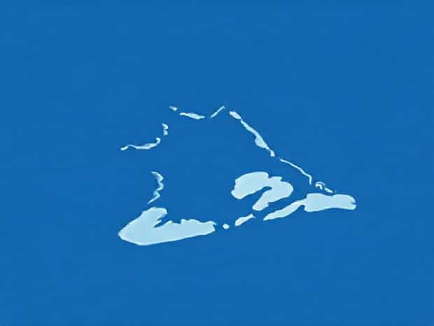
Map Of Lake Champlain
Lake Champlain is a remarkable freshwater lake situated in the northeastern United States, bordered by the states of New York and Vermont, and extending north into the Canadian province of Quebec. The lake spans approximately 120 miles in length and up to 12 miles in width, making it a significant geographic feature in the region. A map of Lake Champlain provides valuable insights into its complex geography, surrounding communities, waterways, and natural resources, making it an essential tool for travelers, environmentalists, and historians alike. Understanding the lake’s geography is crucial for planning recreational activities, managing environmental conservation efforts, and appreciating the historical significance of the region.
Geographical Overview of Lake Champlain
Lake Champlain lies in a valley between the Adirondack Mountains of New York and the Green Mountains of Vermont. Its elongated shape stretches from the southern end near Whitehall, New York, to the northern end near the Richelieu River in Quebec, Canada. The lake is fed by numerous rivers, including the Missisquoi and Lamoille rivers, and eventually drains northward into the Richelieu River, which connects to the St. Lawrence River. The map of Lake Champlain highlights the lake’s major inflows and outflows, islands, peninsulas, and nearby towns, providing a comprehensive understanding of its topography and hydrology.
Importance of a Lake Champlain Map
A detailed map of Lake Champlain serves multiple purposes. It helps visitors navigate recreational areas such as marinas, beaches, and hiking trails. Boaters and fishermen rely on maps to locate safe navigation channels, fishing spots, and protected areas. Environmental scientists use maps to study aquatic ecosystems, monitor water quality, and track wildlife habitats. Additionally, maps help local authorities plan infrastructure projects, emergency response routes, and tourism development strategies.
Major Features Highlighted on the Map
The map of Lake Champlain includes several critical features that define its unique landscape and historical significance
- IslandsThe lake contains over 80 islands, with notable examples including Grand Isle, South Hero, and Isle La Motte. These islands provide recreational opportunities and host unique ecosystems that are important for conservation.
- PeninsulasThe lake features several prominent peninsulas, such as the Cumberland Head in New York, which extends into the lake and offers scenic views and recreational areas.
- Inflow and Outflow RiversMaps clearly mark the major rivers feeding into Lake Champlain, including the Missisquoi River, Lamoille River, and Otter Creek, as well as its primary outflow through the Richelieu River in Canada.
- Shoreline CommunitiesTowns and cities along the lake, such as Burlington, Vermont, and Plattsburgh, New York, are identified, illustrating the human settlement patterns along the lake’s perimeter.
- Maritime Navigation RoutesMaps highlight safe channels for boating, ferry routes, and areas restricted for environmental protection or safety reasons.
Historical Significance Illustrated on the Map
The map of Lake Champlain also reflects its historical importance. During the American Revolutionary War and the War of 1812, the lake served as a strategic route for military movements and naval battles. Maps indicate locations of historic forts, such as Fort Ticonderoga in New York and Fort Chambly in Quebec, providing context for historical tours and educational purposes. These historical sites remain popular destinations for tourists and scholars studying the region’s military and cultural history.
Recreational Use and Tourism
Recreation around Lake Champlain is extensive, and a detailed map helps visitors maximize their experience. The lake is popular for boating, kayaking, sailing, and fishing. Maps highlight boat launches, marinas, and safe navigation routes, ensuring a safe and enjoyable experience. Hiking trails and state parks along the lake are also indicated, allowing tourists to explore scenic landscapes, wildlife habitats, and picnic areas. Winter activities, such as ice fishing and cross-country skiing, can also be planned with reference to detailed maps showing accessible locations and safety information.
Environmental and Ecological Insights
The map of Lake Champlain provides vital information for environmental monitoring and conservation. It identifies wetlands, protected areas, and habitats of endangered species. Scientists use maps to track water quality, invasive species, and changes in shoreline vegetation. Environmental organizations reference these maps to educate the public about pollution prevention, sustainable fishing practices, and the preservation of natural resources. Understanding the ecological layout helps policymakers implement conservation strategies that protect the lake and its surrounding ecosystems.
Transportation and Accessibility
Maps of Lake Champlain also serve a practical purpose for transportation planning. Ferries operate across the lake, connecting communities in Vermont and New York, and maps provide schedules, routes, and docking locations. Road networks along the lake are marked, helping travelers plan trips and identify scenic routes. The lake’s proximity to major highways and airports is also illustrated, making it easier for tourists from distant regions to access its natural attractions.
Cross-Border Connections
Lake Champlain’s location along the U.S.-Canada border adds an international dimension. Maps highlight border crossings, customs points, and regulations for international travelers. The northern part of the lake connects to the Richelieu River, which flows into Quebec, linking the lake to Canadian waterways. Understanding these connections is important for shipping, tourism, and cross-border collaboration in environmental management and emergency response.
Planning and Safety Considerations
Using a detailed map of Lake Champlain is essential for planning and safety. Boaters and kayakers can identify shallow areas, underwater hazards, and safe anchor points. Hikers and campers can locate trailheads, campsites, and emergency access points. Additionally, maps help in understanding weather patterns, prevailing winds, and seasonal water levels, which are crucial for both recreational and commercial activities. Local authorities and search and rescue teams also rely on maps for coordinating emergency responses and maintaining public safety around the lake.
Technological Advancements in Lake Maps
Modern maps of Lake Champlain have been enhanced with digital tools, GPS integration, and satellite imagery. These advancements allow for real-time navigation, precise location tracking, and interactive exploration of the lake. Online maps and mobile applications provide layers of information, such as water depth, fishing hotspots, and hiking trails, making it easier for users to access detailed geographic information without physical maps. Such technology improves safety, convenience, and accessibility for everyone exploring the lake.
Lake Champlain is a vital geographic and cultural feature of the northeastern United States, and a detailed map provides essential insights into its natural, historical, and recreational significance. Stretching across New York, Vermont, and into Quebec, Canada, the lake encompasses diverse ecosystems, islands, peninsulas, and shore communities. Maps illustrate navigation routes, historical sites, environmental zones, and recreational facilities, helping visitors, researchers, and local authorities understand and utilize the lake effectively.
From planning outdoor adventures to studying ecological systems and preserving historical landmarks, a map of Lake Champlain is an indispensable tool. It reflects the lake’s complex geography, rich history, and multifaceted uses, serving as a guide for tourists, environmentalists, historians, and everyday travelers. Understanding Lake Champlain through its map enhances appreciation for this natural treasure, ensuring that it remains accessible, safe, and preserved for future generations.