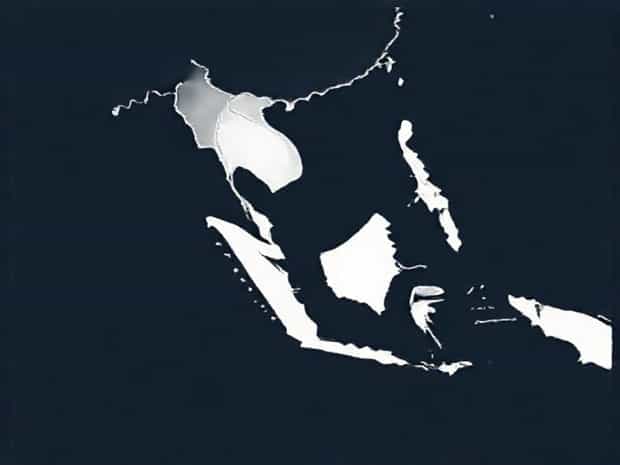
Map Of Insular Southeast Asia
The map of Insular Southeast Asia provides a fascinating glimpse into a region rich in diversity, culture, and natural beauty. This part of Southeast Asia is primarily composed of islands, forming an extensive archipelago that stretches across thousands of kilometers of the Pacific and Indian Oceans. From the bustling urban centers of Jakarta and Manila to the serene landscapes of Bali and Borneo, the region offers a unique blend of geography, climate, and human activity. Understanding the map of Insular Southeast Asia is essential for appreciating its strategic importance, economic potential, and cultural richness. This topic explores the geography, key islands, countries, and significant features of this region in a way that is both informative and easy to understand.
Geographical Overview of Insular Southeast Asia
Insular Southeast Asia, often referred to as Maritime Southeast Asia, includes countries that are predominantly made up of islands. This region covers thousands of islands scattered across major seas, including the South China Sea, the Java Sea, the Celebes Sea, and the Sulu Sea. The area is known for its complex coastline, volcanic activity, and lush tropical forests. The region’s strategic location has historically made it a hub for trade, migration, and cultural exchange.
Major Countries in the Region
The main countries in Insular Southeast Asia include Indonesia, the Philippines, East Timor, Brunei, and parts of Malaysia. Each of these countries occupies a unique portion of the archipelago
- IndonesiaThe largest country in the region, Indonesia consists of over 17,000 islands, including Sumatra, Java, Borneo (shared with Malaysia and Brunei), Sulawesi, and New Guinea (shared with Papua New Guinea).
- PhilippinesAn archipelago of over 7,000 islands, the Philippines is divided into three major island groups Luzon, Visayas, and Mindanao.
- East TimorLocated on the eastern part of the island of Timor, this country occupies a strategic position near the Timor Sea and has a rugged terrain.
- BruneiA small nation on the island of Borneo, Brunei is known for its dense rainforests and oil-rich economy.
- MalaysiaWhile part of Malaysia lies on the Malay Peninsula, the East Malaysian states of Sabah and Sarawak are located on Borneo.
Key Islands and Archipelagos
Insular Southeast Asia features some of the world’s most famous islands, each with distinct geographic and cultural characteristics
- SumatraKnown for its volcanoes, dense rainforests, and diverse wildlife, including tigers and orangutans.
- JavaThe most populous island in the world, with major cities like Jakarta and Surabaya, and significant cultural landmarks.
- BorneoShared by Indonesia, Malaysia, and Brunei, Borneo is rich in biodiversity and dense tropical forests.
- SulawesiRecognized for its unique shape, mountainous terrain, and marine biodiversity.
- Luzon and MindanaoThe two largest islands of the Philippines, featuring a mix of urban areas, mountains, and coastal regions.
- New GuineaThe second-largest island in the world, home to vast rainforests and indigenous communities.
Climate and Natural Features
The climate of Insular Southeast Asia is predominantly tropical, characterized by high humidity, heavy rainfall, and distinct wet and dry seasons. The region is part of the Pacific Ring of Fire, which makes it prone to volcanic eruptions and earthquakes. Rainforests, coral reefs, and mangroves dominate the natural landscape, providing critical habitats for diverse species of plants and animals. These natural features also influence the economy, as fishing, agriculture, and tourism are major industries.
Volcanic Activity
Volcanic activity is a defining feature of the region. Numerous volcanoes, such as Mount Merapi in Java and Mount Mayon in the Philippines, shape the terrain and contribute to fertile soil that supports agriculture. However, volcanic eruptions also pose risks to local populations and infrastructure.
Rivers and Coastlines
Rivers such as the Kapuas in Borneo and the Mahakam in Indonesia provide vital water sources for agriculture and transportation. The extensive coastlines facilitate trade and fishing, making the region economically significant both locally and internationally.
Historical and Cultural Significance
The map of Insular Southeast Asia reflects not only geographic boundaries but also the rich cultural tapestry of the region. Ancient trade routes connected these islands to India, China, and later Europe, influencing local customs, languages, and religions. Today, the islands remain culturally vibrant, with unique traditions, festivals, and culinary practices that vary from one island to another.
Trade and Strategic Importance
Insular Southeast Asia has historically been a critical hub for maritime trade. Straits such as Malacca and Makassar serve as important shipping routes, connecting the Pacific and Indian Oceans. This strategic location continues to impact global trade, shipping, and economic policies of the countries in the region.
Tourism and Natural Attractions
The islands attract millions of tourists each year. Popular destinations include Bali, Boracay, and Borneo, known for their beaches, wildlife, and cultural heritage. Tourism plays a crucial role in the economies of these island nations and encourages the preservation of natural habitats and cultural sites.
Using the Map for Navigation and Study
A detailed map of Insular Southeast Asia is essential for understanding the relationships between islands, countries, and seas. It helps in planning travel, studying biodiversity, conducting research, and understanding geopolitical dynamics. Modern digital maps provide interactive features that allow users to explore topography, political boundaries, and environmental zones in detail.
Educational and Research Applications
Researchers and students use maps of Insular Southeast Asia to study climate patterns, volcanic activity, population distribution, and marine biodiversity. Maps also aid in disaster preparedness, resource management, and urban planning, making them indispensable tools for both education and policy-making.
The map of Insular Southeast Asia is more than a visual representation; it is a window into a diverse and dynamic region. By exploring its islands, countries, climate, and cultural heritage, one gains a deeper understanding of the strategic and environmental significance of Maritime Southeast Asia. From the volcanic landscapes of Indonesia to the tropical beaches of the Philippines, each island contributes to a rich tapestry of geography, biodiversity, and human civilization. Studying this map provides insights into trade, culture, and the natural environment, highlighting the importance of preserving and understanding this remarkable part of the world.