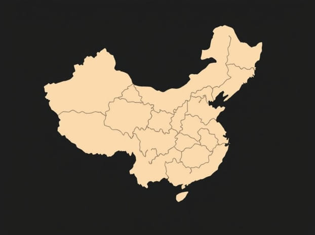
Great Wall Of China Mapped Out
The Great Wall of China is one of the most iconic architectural wonders in the world, stretching across mountains, deserts, grasslands, and plateaus. When mapped out, it reveals not just a single wall, but a vast network of fortifications built over centuries by different dynasties. This incredible structure, when traced on a map, shows how it weaves through thousands of miles of terrain, symbolizing China’s strength, history, and resilience. Understanding how the Great Wall of China is mapped out helps uncover its complexity and the strategic importance it held in ancient times.
The Scale of the Great Wall of China
The Great Wall is often imagined as one continuous line, but mapping it reveals a different reality. It consists of multiple walls, trenches, watchtowers, and natural barriers strategically linked together. When measured in total, including all branches, the wall extends over 21,000 kilometers, according to modern archaeological surveys. This makes it the longest man-made structure on Earth, and mapping its exact course has been a major project for historians and geographers alike.
Geographic Coverage
The mapped route of the Great Wall stretches across northern China, passing through 15 provinces, municipalities, and autonomous regions. It starts from the eastern Shanhaiguan Pass in Hebei Province, running all the way to Jiayuguan Pass in Gansu Province in the west. Along its path, it crosses mountains like Yan and Taihang, rivers such as the Yellow River, and deserts like the Gobi. The geographical spread reflects how the wall adapted to the natural terrain for defense purposes.
Mapping the Historical Construction
The Great Wall was not built in one era. Mapping its layers reveals contributions from many dynasties, each leaving its own mark on the structure. The most prominent sections we see today were built during the Ming Dynasty, but earlier dynasties like the Qin, Han, and Northern Wei also contributed.
Qin Dynasty Mapping
The first emperor of China, Qin Shi Huang, ordered the connection of several regional walls around 221 BCE. Mapping this era shows shorter stretches built mainly with tamped earth, forming the early foundation of the Great Wall network.
Han Dynasty Mapping
During the Han Dynasty, the wall extended further west to protect Silk Road trade routes. Maps of this period highlight fortresses and beacon towers in desert regions, ensuring communication and defense over vast distances.
Ming Dynasty Mapping
The Ming Dynasty left behind the strongest and most enduring parts of the wall. Mapping Ming contributions reveals stone and brick structures fortified with watchtowers, garrisons, and military outposts. These remain the most preserved and visited sections today.
How Modern Technology Mapped the Great Wall
For centuries, mapping the Great Wall was difficult due to its sheer length and the variety of terrains it crosses. Modern tools like satellite imagery, drones, and ground-penetrating radar have made it possible to chart its course accurately. Archaeologists have been able to identify hidden sections buried by sand or overgrown by vegetation, ensuring that the mapped outline is as complete as possible.
Satellite Mapping
Satellite technology allows researchers to trace even remote parts of the wall. High-resolution images reveal paths through deserts and mountains where traditional surveying would be extremely challenging.
Digital Mapping Projects
Several digital mapping initiatives have recreated the wall in virtual form, providing interactive maps that allow people to explore different sections online. These digital maps highlight the wall’s scale and diversity, from restored tourist sites to ruins in the wilderness.
Key Sections Highlighted on Maps
When the Great Wall of China is mapped out, certain sections stand out for their historical importance and architectural features. Here are some of the most significant parts
- Shanhaiguan PassKnown as the First Pass Under Heaven, it marks the eastern starting point of the wall.
- BadalingNear Beijing, this section is the most visited and restored, often highlighted on tourist maps.
- MutianyuAnother well-preserved part close to Beijing, famous for its scenic surroundings.
- Jiayuguan PassThe westernmost point of the Great Wall, located in Gansu Province.
- Gubeikou and JinshanlingThese sections show a mix of restored and wild wall areas, often noted on trekking maps.
Strategic Importance Revealed by Mapping
Mapping the Great Wall highlights how it was not just a physical barrier but also a system of defense and communication. Watchtowers were spaced strategically for visibility, and beacon towers were used to send smoke or fire signals across vast distances. The mapped alignment along mountain ridges and river valleys shows how natural geography was integrated into military strategy.
Defense Network
The Great Wall acted as a defensive shield against invasions from nomadic tribes. Mapping its forts and garrisons reveals how troops were stationed at regular intervals to respond quickly to threats.
Trade and Control
Mapping also shows how the wall monitored trade routes, particularly during the Han Dynasty. Its proximity to the Silk Road meant that officials could regulate goods, collect taxes, and ensure the safety of merchants.
The Cultural Impact of Mapping the Wall
Beyond military and economic functions, mapping the Great Wall underscores its cultural significance. It represents unity, perseverance, and the determination of the Chinese people. Maps of the wall are not just geographic tools but cultural symbols, showing how generations contributed to this monumental achievement.
Tourism and Education
Today, mapped sections of the Great Wall attract millions of visitors from around the world. Educational maps help students and historians visualize its scale and learn about different dynastic contributions.
Preservation Efforts
Mapping also plays a vital role in preservation. Identifying lesser-known sections ensures that restoration efforts are not limited to tourist spots but extend to fragile ruins at risk of disappearing.
Challenges in Mapping
Despite technological advancements, mapping the Great Wall comes with challenges. Erosion, natural disasters, and human development have destroyed many parts. Some sections are so remote that access is still difficult. Furthermore, myths and legends surrounding the wall add to the confusion, making it important to separate fact from folklore in official mapping projects.
The Great Wall of China, when mapped out, reveals a vast and intricate network that goes far beyond the image of a single wall stretching across the horizon. It is a story of centuries of construction, adaptation, and resilience, spanning mountains, deserts, and plains. Modern mapping technology has made it possible to understand its true scale and importance, while highlighting the need for preservation. By exploring maps of the Great Wall, we gain insight into both its historical role and its enduring legacy as one of humanity’s greatest architectural achievements.