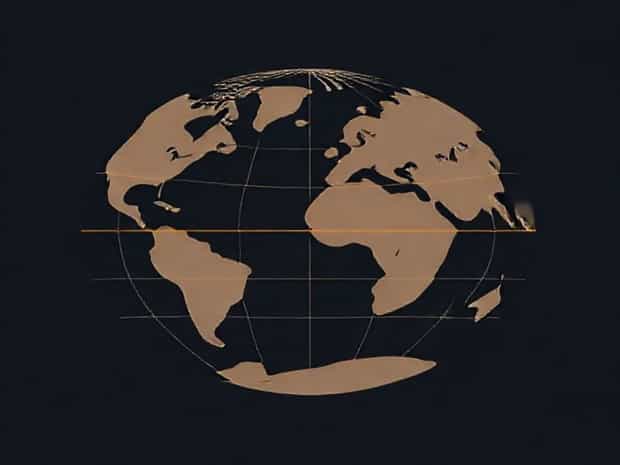
Global Atmospheric Circulation Diagram
Global atmospheric circulation is a fundamental concept in understanding how air moves around our planet, distributing heat, moisture, and energy across different regions. This movement of air drives weather patterns, climate zones, and the distribution of deserts, rainforests, and temperate regions. A global atmospheric circulation diagram is a useful tool for visualizing these complex processes, illustrating the major wind belts, pressure zones, and convection cells that shape Earth’s climate. By studying such diagrams, scientists, students, and weather enthusiasts can gain insight into how air circulates from the equator to the poles, and how these patterns affect daily weather and long-term climate phenomena.
Understanding the Basics of Atmospheric Circulation
Atmospheric circulation is the large-scale movement of air through Earth’s atmosphere, driven primarily by the uneven heating of the planet by the sun. The equator receives more direct sunlight, warming the air and causing it to rise. Conversely, the poles receive less solar energy, making the air cooler and denser. This temperature difference creates pressure gradients that drive the movement of air from high-pressure areas to low-pressure areas, forming the foundation of global wind patterns. The Coriolis effect, caused by the rotation of the Earth, further influences the direction of these winds, resulting in distinct circulation cells and wind belts.
Major Circulation Cells
Global atmospheric circulation is typically divided into three main circulation cells in each hemisphere
- Hadley CellsThese cells operate between the equator and approximately 30 degrees latitude. Warm air rises at the equator, creating low pressure and heavy rainfall, then moves poleward at high altitudes before descending at around 30 degrees, forming subtropical high-pressure zones and deserts.
- Ferrel CellsFound between 30 and 60 degrees latitude, Ferrel cells act as a transitional zone. Air in these cells moves in the opposite direction of Hadley and Polar cells, generating westerly winds and contributing to the temperate climate zones.
- Polar CellsOperating from 60 degrees latitude to the poles, Polar cells involve cold, dense air descending at the poles, moving toward lower latitudes at the surface, and rising again near 60 degrees. This creates polar easterlies and polar front zones where storms often develop.
Wind Belts and Their Importance
Wind belts are closely related to the circulation cells and are depicted clearly in global atmospheric circulation diagrams. These belts determine the prevailing wind directions across the world and influence weather systems significantly
- Trade WindsFound near the equator, trade winds blow from the northeast in the Northern Hemisphere and from the southeast in the Southern Hemisphere. They are responsible for tropical weather patterns and aid in the formation of tropical storms.
- WesterliesLocated in the mid-latitudes, these winds blow from the west to the east and play a key role in driving weather systems in temperate regions.
- Polar EasterliesThese winds move from east to west near the poles and influence cold-weather systems and polar climates.
Pressure Zones and Climatic Effects
Global atmospheric circulation diagrams also indicate the major high and low-pressure zones, which affect regional climates
- Equatorial Low PressureAlso known as the Intertropical Convergence Zone (ITCZ), this area experiences constant rising warm air, leading to heavy rainfall and tropical rainforest climates.
- Subtropical High PressureLocated around 30 degrees latitude, these zones feature descending air that creates arid deserts such as the Sahara and Australian Outback.
- Subpolar Low PressureAround 60 degrees latitude, rising air generates stormy weather, frequent precipitation, and supports temperate forests.
- Polar High PressureNear the poles, cold descending air produces dry and frigid conditions, characteristic of polar deserts and ice-covered regions.
How Global Atmospheric Circulation Affects Weather
The interaction of circulation cells, wind belts, and pressure zones determines the weather experienced in different parts of the world. Tropical regions under the influence of Hadley cells experience consistent rainfall and high humidity, whereas subtropical regions under descending air remain dry. Mid-latitude areas influenced by Ferrel cells experience variable weather with seasonal changes, including storms and frontal systems. Polar regions receive minimal precipitation and extreme cold due to stable high-pressure systems. These patterns are essential for understanding not only local weather but also global climate behavior.
Seasonal Variations and the Role of the ITCZ
The Intertropical Convergence Zone (ITCZ) shifts north and south with the Sun’s zenith position throughout the year. This seasonal movement affects rainfall patterns in tropical regions, leading to wet and dry seasons in areas such as West Africa, India, and Southeast Asia. Global atmospheric circulation diagrams often illustrate these shifts, helping meteorologists predict seasonal weather changes and monsoon patterns. The movement of the ITCZ also influences tropical storm formation, as rising warm air in this zone can lead to cyclones and hurricanes under the right conditions.
Applications of a Global Atmospheric Circulation Diagram
Using a global atmospheric circulation diagram provides several practical benefits
- EducationDiagrams are invaluable for teaching students about climate systems, wind patterns, and weather phenomena, offering a visual representation of abstract concepts.
- MeteorologyMeteorologists rely on these diagrams to predict weather events and understand the interaction of global wind and pressure systems.
- Climate StudiesResearchers use circulation diagrams to study climate zones, desert formation, tropical rain distribution, and long-term changes in global weather patterns.
- Environmental PlanningUnderstanding atmospheric circulation helps in agriculture, urban planning, and disaster preparedness, particularly for storm-prone or drought-affected regions.
A global atmospheric circulation diagram is a powerful tool for understanding the movement of air, wind patterns, pressure zones, and climatic effects around the Earth. The diagram visually represents Hadley, Ferrel, and Polar cells, along with trade winds, westerlies, and polar easterlies, allowing us to comprehend how heat and moisture are distributed across the planet. By studying these diagrams, scientists, educators, and the general public gain valuable insight into the mechanisms behind weather and climate, the formation of deserts and rainforests, and seasonal rainfall patterns. Understanding global atmospheric circulation is essential for predicting weather, managing natural resources, and preparing for climate-related challenges in a changing world.