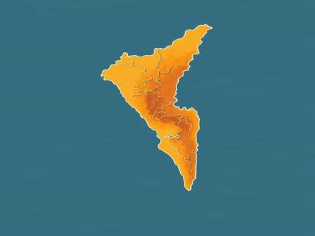
Geographical Kerala Physiography Map
Kerala, a state located in the southwestern part of India, is renowned for its diverse and unique physiography that makes it a distinctive region in terms of geography. The geographical physiography of Kerala is characterized by the presence of Western Ghats, coastal plains, midlands, and numerous rivers and backwaters, forming a varied landscape that influences climate, agriculture, and settlement patterns. A detailed Kerala physiography map helps understand the distribution of these physical features, their interconnections, and their impact on human life. Studying Kerala’s geographical physiography is essential for planners, geographers, environmentalists, and tourists as it provides insights into topography, land use, water resources, and ecological significance. The state’s topography has shaped its economy, culture, and lifestyle, with hills, plains, and wetlands offering both challenges and opportunities for sustainable development.
Major Physiographic Divisions of Kerala
Kerala’s physiography can be broadly divided into four main regions the Western Ghats, midlands, coastal plains, and the backwater system. Each region has distinct characteristics that contribute to the overall geographical diversity of the state.
Western Ghats
The Western Ghats form the eastern boundary of Kerala and are a UNESCO World Heritage site due to their rich biodiversity. This mountain range runs parallel to the western coast of India and has an average elevation of 900 to 1,800 meters, with some peaks exceeding 2,500 meters. The Western Ghats in Kerala are responsible for the state’s high rainfall as they intercept the southwest monsoon winds. The region is characterized by steep slopes, dense forests, and fertile soil that supports plantations of tea, coffee, spices, and rubber. Numerous rivers originate from these mountains, flowing westward into the Arabian Sea, shaping valleys and gorges along the way.
Midlands
The midland region lies between the Western Ghats and the coastal plains, forming a transitional zone with rolling hills, small valleys, and laterite plateaus. The midlands are less elevated than the Ghats but higher than the coastal plains, ranging from 75 to 150 meters above sea level. This region supports extensive agriculture due to fertile soil and moderate rainfall. Crops such as paddy, coconut, banana, and spices thrive in this zone. Towns and urban settlements are often concentrated in the midlands due to the relatively flatter terrain compared to the steep slopes of the Ghats.
Coastal Plains
Kerala’s coastal plains stretch along the Arabian Sea and are characterized by sandy beaches, estuaries, and lagoons. The plains are narrow in the northern districts and wider in the south, forming fertile tracts suitable for rice cultivation and coconut groves. The coastal plains are highly populated due to easy access to trade, fishing, and transportation. Port cities like Kochi and Kollam are located in this region, serving as major economic and cultural centers. The plains also feature numerous rivers, estuaries, and backwaters that provide natural drainage and support inland water navigation.
Backwaters and Wetlands
Kerala is famous for its backwaters, a unique network of interconnected canals, rivers, lakes, and lagoons that run parallel to the coast. These backwaters are mainly located in the districts of Alappuzha, Kollam, and Kottayam. The backwater system supports inland fisheries, agriculture, and tourism, forming an important part of Kerala’s economy. Wetlands and lagoons in these areas act as natural flood control systems, recharge groundwater, and provide habitats for migratory birds and aquatic species.
Rivers and Drainage System
Kerala has more than 40 rivers, all originating from the Western Ghats and flowing westward into the Arabian Sea. These rivers are generally short and fast-flowing due to the steep gradient of the Ghats. Major rivers include Periyar, Bharathapuzha, Pamba, and Chalakudy. The river systems play a crucial role in irrigation, hydropower generation, and navigation. Kerala’s physiography, with its mountains and plains, ensures that rivers form a dendritic pattern, contributing to fertile alluvial plains in the midlands and coastal areas.
Significance of Rivers
- Provide irrigation for paddy fields and plantations.
- Support inland navigation and transport in the backwaters.
- Generate hydroelectric power from mountain streams.
- Maintain ecological balance by supporting aquatic habitats and wetlands.
Topography and Landforms
The topography of Kerala is diverse, ranging from high mountains and plateaus in the east to flat coastal plains in the west. The Western Ghats feature peaks, ridges, and valleys, while the midlands are rolling hills interspersed with small rivers and streams. The coastal plains are flat, with sandy beaches and fertile alluvial soil. Landforms such as laterite plateaus, hillocks, and river deltas define the midlands and coastal regions. This diversity in landforms influences settlement patterns, agricultural practices, and infrastructure development.
Key Landforms in Kerala
- Western Ghats High peaks, deep valleys, and gorges.
- Midlands Rolling hills, small valleys, and laterite plateaus.
- Coastal Plains Sandy beaches, estuaries, and lagoons.
- Backwaters Canals, lakes, and wetlands providing inland water transport.
Climatic Influence on Physiography
Kerala’s physiography is closely linked to its climate, which is tropical monsoon in nature. The Western Ghats intercept the southwest monsoon winds, resulting in heavy rainfall in the highlands and moderate rainfall in the midlands and coastal plains. This rainfall nourishes rivers, backwaters, and wetlands, contributing to the lush greenery of the state. The coastal plains experience relatively high humidity and moderate temperatures, while the highlands enjoy cooler climates due to elevation. The physiography and climate together support Kerala’s rich biodiversity and agricultural productivity.
Impact of Monsoons
- Enhances fertility of alluvial plains through regular flooding and silt deposition.
- Maintains water levels in rivers, lakes, and backwaters.
- Supports plantation crops such as tea, coffee, rubber, and spices in the highlands.
- Influences human settlement patterns and economic activities in different regions.
Significance of a Physiography Map
A Kerala physiography map provides a visual representation of the state’s physical features, elevation, and landforms. It helps students, researchers, and planners understand the distribution of mountains, plains, rivers, and coastal areas. Physiography maps are essential for environmental management, disaster planning, and development projects. They also assist in tourism planning by highlighting scenic locations, hill stations, and backwater routes. Such maps illustrate the relationship between natural features and human activity, showing how geography influences culture, economy, and lifestyle in Kerala.
Uses of Physiography Maps
- Educational purposes for geography students and researchers.
- Planning and management of natural resources like rivers, forests, and soil.
- Tourism development, highlighting hill stations, backwaters, and coastal areas.
- Disaster management, including flood and landslide risk assessment.
- Urban planning and infrastructure development based on topography and landforms.
Kerala’s geographical physiography is a remarkable example of natural diversity, combining high mountains, rolling midlands, coastal plains, and an extensive backwater system. The Western Ghats, midlands, and coastal regions, along with numerous rivers, wetlands, and landforms, create a complex and interconnected landscape. Understanding Kerala’s physiography through detailed maps is essential for environmental conservation, urban planning, tourism, and educational purposes. The state’s physical features, influenced by climate and monsoon patterns, support agriculture, biodiversity, and human settlement, highlighting the critical relationship between geography and lifestyle. From the peaks of the Western Ghats to the tranquil backwaters, Kerala’s physiography provides a unique blend of natural beauty, ecological importance, and economic significance that continues to shape the state’s identity and development.
Studying the geographical Kerala physiography map allows for a deeper appreciation of the state’s diverse landscapes, revealing how mountains, plains, rivers, and coasts coexist and influence human life. This comprehensive understanding is invaluable for planners, environmentalists, tourists, and locals alike, emphasizing the importance of preserving Kerala’s unique natural and cultural heritage.