Facts About The Bering Strait
The Bering Strait is a narrow body of water that holds immense historical, geographical, and ecological significance. Situated between Russia and Alaska, this strait connects the Arctic Ocean with the Bering Sea and serves as a natural boundary between two continents, Asia and North America. Over thousands of years, the Bering Strait has influenced human migration, marine ecosystems, and global climate patterns. Its unique location and harsh conditions make it a subject of interest for geographers, historians, ecologists, and climate scientists alike. Exploring facts about the Bering Strait reveals its vital role in shaping both human history and the natural environment.
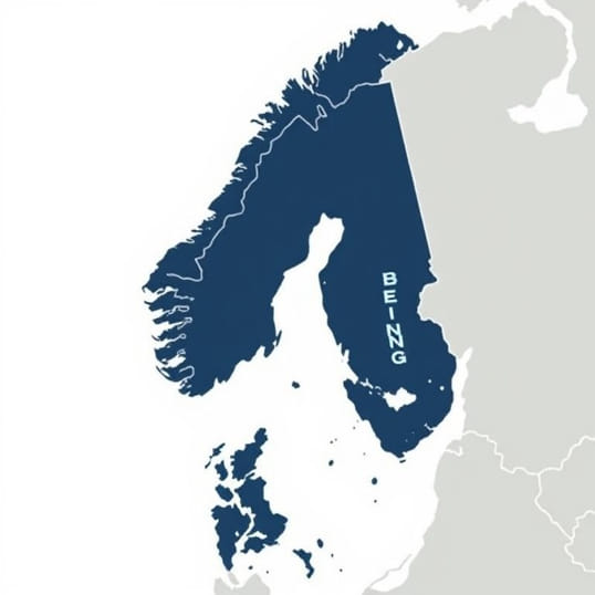
Geographical Overview
The Bering Strait is approximately 82 kilometers (51 miles) wide at its narrowest point, separating the Chukchi Peninsula of Russia from the Seward Peninsula of Alaska. The strait’s shallow waters generally measure about 30 to 50 meters in depth, though variations exist depending on tides and seabed topography. It connects the Arctic Ocean to the north with the Bering Sea to the south, forming an important corridor for ocean currents, ice movement, and marine life. The strait’s geographical position also creates a natural boundary between the continents of Asia and North America.
Key Islands in the Strait
Within the Bering Strait lie two notable islands that further define its geography Big Diomede and Little Diomede. Big Diomede belongs to Russia, while Little Diomede belongs to the United States. These islands are separated by a narrow channel known as the International Date Line, which also marks the division between the two countries. The islands are only about 4 kilometers (2.5 miles) apart, yet they are divided by political borders and time zones, making them unique points of interest for both geography and international relations.
- Big Diomede Island (Russia) Known for its rugged terrain and largely uninhabited landscape.
- Little Diomede Island (USA) Inhabited by indigenous communities, offering insights into traditional Arctic life.
Historical Significance
The Bering Strait has played a pivotal role in human history, particularly in theories regarding the peopling of the Americas. During the last Ice Age, lower sea levels exposed a land bridge known as Beringia, connecting Asia and North America. This land bridge allowed early humans and animals to migrate between continents. Archaeological evidence suggests that humans crossed this region thousands of years ago, ultimately populating North America. This makes the Bering Strait a critical point in understanding human migration, adaptation, and the spread of cultures across the globe.
Exploration and Naming
The strait is named after Vitus Bering, a Danish explorer in Russian service who navigated these waters in the early 18th century. Bering’s voyages helped map the Arctic and northern Pacific regions, establishing the strait’s importance in global navigation. Subsequent explorers and scientists have studied the Bering Strait extensively, documenting its marine life, climatic conditions, and navigational challenges.
Climate and Ice Conditions
The Bering Strait is characterized by a harsh Arctic climate, with long, freezing winters and brief, cool summers. Sea ice is a defining feature, with the strait often frozen from October to June, affecting navigation and wildlife migration. Seasonal ice flows and strong currents create a dynamic environment that supports unique Arctic ecosystems. Understanding the strait’s climate is essential for studying the impacts of global warming, as changes in sea ice patterns influence ocean circulation, wildlife behavior, and local communities.
Effects of Climate Change
- Melting Sea Ice Rising temperatures have led to earlier ice melt, affecting species like walrus, seals, and polar bears.
- Navigation Opportunities Reduced ice coverage has increased shipping traffic, opening new Arctic trade routes.
- Environmental Concerns Melting ice also threatens indigenous communities and delicate ecosystems, raising conservation challenges.
Wildlife and Marine Ecosystem
The Bering Strait is a critical habitat for numerous marine and terrestrial species. The nutrient-rich waters support large populations of fish, including salmon and cod, which are vital to local fisheries. Migratory marine mammals such as bowhead whales, beluga whales, and walruses rely on the strait for seasonal feeding and passage. Bird species, including Arctic terns and various seabirds, also depend on the area during migration. The unique mix of Arctic and sub-Arctic conditions creates a biodiversity hotspot that is both fragile and highly productive.
Conservation Efforts
Conservation organizations and governments monitor the Bering Strait region to protect its ecosystems from overfishing, pollution, and climate-related impacts. Establishing marine protected areas and regulating shipping and fishing activities are crucial measures to preserve wildlife and maintain ecological balance. Scientists also study the strait to better understand migratory patterns, species interactions, and the overall health of the Arctic marine environment.
Cultural and Indigenous Significance
Indigenous communities have inhabited regions surrounding the Bering Strait for thousands of years. In Alaska, Inupiat communities rely on the strait’s waters for subsistence hunting and fishing. Similarly, Chukchi communities in Russia have traditional practices tied to the strait’s resources. These communities possess extensive knowledge of ice conditions, wildlife behavior, and seasonal patterns, contributing to both cultural preservation and environmental stewardship.
Traditional Practices
- Subsistence Hunting Hunting marine mammals and fish is a key part of local diets and cultural identity.
- Seasonal Migration Indigenous populations have adapted to the strait’s changing ice and wildlife patterns for centuries.
- Knowledge Sharing Traditional ecological knowledge helps scientists understand the long-term changes in the Bering Strait region.
Geopolitical Importance
The Bering Strait holds strategic geopolitical significance due to its location between the United States and Russia. It serves as a potential route for shipping, energy exploration, and military considerations. The proximity of the Diomede Islands highlights the international dimension of the strait, with both countries monitoring activities and maintaining border regulations. Additionally, the strait’s location near key Arctic resources makes it a focal point for discussions on international cooperation, maritime law, and environmental protection.
International Cooperation
Despite geopolitical complexities, the United States and Russia have collaborated on environmental monitoring, search and rescue operations, and sustainable development initiatives in the Bering Strait. Multilateral agreements also involve indigenous representation, scientific research, and ecological conservation efforts. Such cooperation is vital to managing the strait’s unique environmental and geopolitical challenges.
The Bering Strait is a remarkable natural feature that connects continents, influences human history, and sustains diverse ecosystems. From its shallow waters and iconic islands to its role in ancient human migration, the strait continues to capture global interest. Its harsh Arctic climate, seasonal sea ice, and rich biodiversity make it a critical region for scientific research and environmental conservation. Indigenous communities maintain deep cultural ties to the strait, highlighting the importance of traditional knowledge in understanding and protecting this unique area. Additionally, the Bering Strait’s geopolitical significance underscores its relevance in global navigation, resource management, and international relations. By exploring the many facts about the Bering Strait, we gain a deeper appreciation for its role in shaping both the natural world and human civilization, emphasizing the need for sustainable management and ongoing study of this critical Arctic passage.