Draw The Map Of Cameroon
Learning how to draw the map of Cameroon is a rewarding project for students, travelers, and anyone who enjoys geography. Cameroon’s outline often described as triangular with a western kink along the Gulf of Guinea combines coastline curves, a long northern stem, and varied borders with Nigeria, Chad, the Central African Republic, Equatorial Guinea, Gabon, and the Republic of the Congo. With a few simple techniques, you can sketch a recognizable Cameroon outline, add key cities and physical features, and finish with a clean, informative map that looks great in notes or presentations.
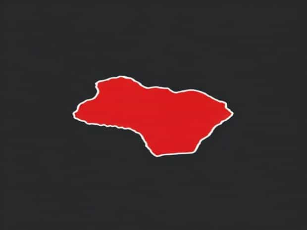
Before You Start Know the Overall Shape
To draw the map of Cameroon accurately, visualize two connected parts
- The southern bodya broad, slightly tilted triangle touching the Atlantic Ocean on the west.
- The northern extensiona narrow stem reaching up toward Lake Chad.
Thinking in simple shapes first makes the coastline and borders easier to place. Keep in mind that Cameroon tilts slightly northeast, not perfectly vertical.
Recommended Materials
You don’t need special tools to draw the map of Cameroon. A basic set works well
- Pencil and eraser for initial lines and corrections.
- Fine black pen for final borders.
- Ruler for neat scale bars and grid lines.
- Colored pencils or a light highlighter for water bodies and altitude shading.
Set Up Size, Orientation, and Scale
Cameroon is taller than it is wide. On an A4 or letter page, place the outline in portrait orientation. Leave room for a title, legend, and scale bar. A practical working box is around 16 cm tall by 10 cm wide so you can include labels without crowding the coast.
Create a Light Guideline Grid (Optional)
Draw a light 2 cm grid to help place features. A grid is especially helpful for beginners and makes it easier to redraw the map of Cameroon consistently.
Step-by-Step Outline
Use the sequence below to build the national outline from broad shapes to details
1) Block in the Southern Triangle
Lightly sketch a tall, slightly leaning triangle occupying the lower two-thirds of your workspace. The left edge will become the Atlantic coastline; the right edges will form borders with Equatorial Guinea, Gabon, the Republic of the Congo, and the Central African Republic.
2) Add the Western Coastline
On the triangle’s left side, curve gently to show the Gulf of Guinea. About one third up from the bottom, add a small inward notch to suggest the Bight and the position near Douala/Limbé. This soft indentation keeps the coastline from looking like a straight line.
3) Shape the Southern Borders
From the southwest corner moving east, draw short, gently broken segments for the borders with Equatorial Guinea and Gabon. Continue into a longer, slightly diagonal boundary with the Republic of the Congo. These lines should look organic no need for perfectly straight segments.
4) Carve the Eastern Edge
Turning north, sketch a more vertical boundary against the Central African Republic. Keep it slightly irregular, then angle northwest as you transition toward Chad farther up.
5) Attach the Northern Stem
From the upper part of your main body, extend a narrow corridor northward. This is the hallmark feature when you draw the map of Cameroon. It should be roughly a third of the total country height. Keep the corridor slim and gently tapering, with a slight bend to the east before ending near Lake Chad.
6) Define the Northwest Border with Nigeria
Return to the coast and work upward from the western shoreline near the base, trace the Nigeria border as a complex, slightly wavy edge that kinks inland and then reconnects to the northern stem. This side provides much of the outline’s character avoid straight lines and allow soft, ankle-like bends.
Refine Key Coastal and Border Details
With the basic silhouette in place, refine a few anchor points so your Cameroon outline looks familiar
- Coastal kinkSlight inward scoop around the southwest coast near Mount Cameroon.
- Northern tipKeep the terminus near Lake Chad rounded, not sharp.
- Northwest bendsGentle steps along the Nigeria boundary add realism.
Add Major Cities for Orientation
Labeling cities helps viewers read the map quickly
- Yaoundé (capital)Place it slightly south of center, a little to the east of the country’s vertical axis.
- DoualaMark near the coast, northwest of Yaoundé, close to the coastal kink.
- GarouaIn the north, below the tip of the stem, slightly west of center.
- MarouaFarther northeast within the northern extension.
- BamendaIn the northwest highlands, inland from the coastal bend.
- Buea/LimbéSouthwest near Mount Cameroon along the coast.
Sketch Physical Geography
To elevate your drawing beyond an outline, add the physical map elements that define Cameroon’s landscapes
Mount Cameroon and the Western Highlands
Place a small triangular mountain symbol near the southwest coast for Mount Cameroon. Shade a band running north from here to show the Cameroon Highlands, a volcanic chain that explains the rugged relief toward Bamenda.
Adamawa Plateau
Across the central belt, add a soft hatched zone to indicate the Adamawa Plateau. This subtle shading separates the forested south from the savanna north and guides the eye along the country’s interior spine.
Major Rivers
- Sanaga RiverDraw a broad, meandering line westward across the southern half, emptying toward the Atlantic near Douala.
- Benue tributariesIn the north, sketch thinner lines trending toward Nigeria to hint at the Benue-linked drainage.
- Nyong and WouriAdd a couple of shorter coastal streams to enrich the hydrography.
Political Regions (Optional Detail)
If you want a political map, lightly subdivide Cameroon into its regions. Keep lines unobtrusive so they don’t overpower the national border. Label sparingly Northwest, Southwest, Littoral, Centre, West, South, East, Adamawa, North, and Far North.
Finishing Touches Legend, Scale, and Orientation
Professional-looking maps share three finishing elements
- North arrowA simple arrow in the corner is enough.
- Scale barDraw a 0-200 km bar with 50 km ticks for clarity.
- LegendInclude small symbols for cities (dots), capital (star), rivers (blue line), mountains (triangle), and region boundaries (dashes).
Common Mistakes and How to Avoid Them
- Northern stem too wideKeep it narrow and tapered; an oversized top makes the map look distorted.
- Straight coastlineAdd gentle curves; Cameroon’s Atlantic edge is not a ruler line.
- Capital placementYaoundé sits slightly south of the country’s latitudinal midpoint; don’t place it too far north.
- Lack of tiltA slight northeast tilt makes the silhouette feel authentic.
Speed Strategy A Simple Memory Shape
When you need to draw the map of Cameroon quickly, remember this mnemonic
- Start with a leaning triangle for the south.
- Add a gentle coastal scoop left of center.
- Attach a thin, curved stem to the north.
- Ruffle the northwest border for natural irregularity.
Color and Thematic Variations
Once the base outline is mastered, you can create thematic maps
- Relief mapUse green in the south, transitioning to yellow and light brown in the highlands and north.
- Climate mapShade the humid coastal zone and rainforest south differently from the drier north.
- Transport mapOverlay main roads and rail lines connecting Douala, Yaoundé, and northern cities.
Practice Routine for Accuracy
Consistency comes from repetition. Practice by tracing your best outline onto blank paper three or four times, reducing reliance on the grid each round. Over time, you’ll internalize the proportions and be able to draw the map of Cameroon freehand with confidence.
Checklist Recognizable Cameroon at a Glance
- Portrait orientation, slight northeast tilt.
- Coastal kink near Mount Cameroon and Douala.
- Narrow, tapering northern extension.
- Capital placed slightly south of center; major cities positioned logically.
- Rivers and highlands sketched with light, readable symbols.
Why This Approach Works
Breaking a complex border into simple shapes reduces guesswork. By layering the triangle base, the coastal curve, the northern stem, and the wavy northwest boundary with Nigeria, you capture Cameroon’s distinctive silhouette. Adding just a few cities and physical features turns an outline into a map that communicates place, distance, and landscape at a glance.
To draw the map of Cameroon well, focus on proportion, a gentle coastal curve, and the slim northern extension. Build the outline with simple shapes, then enrich it with cities, rivers, highlands, and a clean legend. With practice, your Cameroon sketch will look both accurate and attractive, whether it appears in classroom notes, a travel journal, or a study guide. This step-by-step method keeps the process clear, repeatable, and enjoyable so your next map of Cameroon will be your best one yet.