Directions To Wrigley Field
Wrigley Field, one of the most iconic baseball stadiums in the United States, is located in the heart of Chicago’s Lakeview neighborhood. Known for its historic charm, ivy-covered walls, and passionate fans, it draws visitors from all over the country and the world. Whether you are attending a Chicago Cubs game, taking a stadium tour, or simply exploring the surrounding neighborhood, knowing the best directions to Wrigley Field is essential for a smooth and enjoyable visit. There are multiple transportation options available, including public transit, driving, walking, and rideshare services, each with its own advantages depending on your starting point and personal preferences.
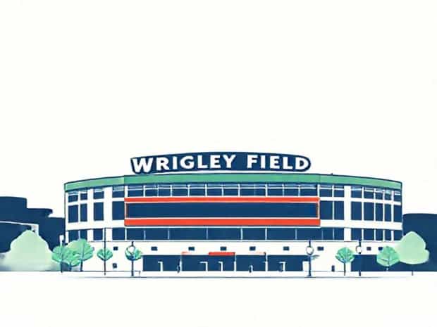
Overview of Wrigley Field
Wrigley Field has been the home of the Chicago Cubs since 1916 and is the second-oldest ballpark in Major League Baseball. Its historic charm, combined with the lively atmosphere of the surrounding Wrigleyville neighborhood, makes it a must-visit destination for sports fans and tourists alike. Beyond baseball, the area offers a variety of restaurants, bars, and shops that enhance the overall experience. The stadium is located at 1060 West Addison Street, providing a clear point of reference for travelers using GPS or maps.
Nearby Landmarks
- Addison Street and Clark Street intersection
- Lakeview neighborhood attractions
- Local bars and restaurants in Wrigleyville
- Rooftop venues with views of the stadium
Directions by Public Transportation
Chicago’s public transportation system is an efficient and convenient way to reach Wrigley Field, especially on game days when traffic and parking may be challenging. The Chicago Transit Authority (CTA) offers both train and bus options that provide easy access to the stadium.
By Train (CTA Red Line)
- Take the Red Line train toward Howard if traveling from downtown Chicago or the South Side.
- Exit at Addison Station, which is a short walk from the stadium’s main entrance.
- Follow signage and the flow of fellow fans along Addison Street to reach Wrigley Field.
- Travel time from downtown Chicago is approximately 20-25 minutes.
By Bus
- CTA bus routes 22, 152, and 146 pass near Wrigley Field, connecting various neighborhoods to the stadium.
- Bus stops are conveniently located along Addison Street and Clark Street for easy access.
- Using the bus is a good option for those coming from areas not served directly by the Red Line.
Driving Directions
Driving to Wrigley Field can be an option for those who prefer the flexibility of a personal vehicle, though it is important to consider limited parking and heavy traffic during events. Planning your route ahead and considering nearby parking garages is recommended.
From Downtown Chicago
- Take Lake Shore Drive northbound and exit at Irving Park Road or Belmont Avenue.
- Continue west toward Clark Street and follow signage for Wrigley Field.
- Travel time is approximately 20-30 minutes without traffic.
From O’Hare International Airport
- Take I-90 East toward downtown Chicago.
- Exit at Addison Street and head east toward Clark Street.
- The total drive is roughly 17 miles and usually takes 35-45 minutes depending on traffic.
From Midway International Airport
- Take I-55 North toward downtown Chicago.
- Merge onto I-90/I-94 North and exit at Addison Street.
- Continue east along Addison Street to reach the stadium, a drive of approximately 15 miles or 35-45 minutes.
Parking Tips
- Wrigley Field has limited on-site parking, so arriving early is recommended.
- Nearby parking garages and lots offer hourly or event-day rates.
- Consider reserving parking in advance to avoid long waits and high fees.
Walking and Cycling Directions
For visitors staying in nearby neighborhoods or using public transportation, walking or cycling to Wrigley Field is a pleasant and practical option. The surrounding streets are pedestrian-friendly, and bike racks are available near the stadium entrances.
Walking from Addison Station
- Exit the Red Line at Addison Station and walk west along Addison Street.
- Cross Clark Street and continue to the main stadium entrance.
- The walk takes about 5 minutes and allows you to enjoy the Wrigleyville atmosphere.
Cycling to the Stadium
- Several bike lanes connect downtown Chicago and Lakeview neighborhoods to Wrigley Field.
- Bike racks are located near the stadium entrances for secure parking.
- Consider using a cycling app to plan the safest route along city streets.
Rideshare and Taxi Options
Rideshare services such as Uber and Lyft provide convenient access to Wrigley Field for visitors who prefer not to drive or navigate public transport. Taxis are also widely available in Chicago, particularly in downtown areas. On game days, pickup and drop-off zones are designated near the stadium, making it easier for visitors to reach their destination safely and efficiently.
Travel Tips for Visiting Wrigley Field
To make the most of your trip to Wrigley Field, consider these tips
- Arrive early to avoid congestion and secure parking if driving.
- Use public transportation when possible to bypass traffic and enjoy a stress-free journey.
- Check the stadium schedule to plan your arrival, especially during high-profile games or events.
- Dress appropriately for weather conditions, as Chicago can be unpredictable.
- Explore nearby bars, restaurants, and shops in Wrigleyville for a full experience.
Getting to Wrigley Field is straightforward with multiple options including public transportation, driving, walking, cycling, and rideshare services. Its central location in Chicago’s Lakeview neighborhood makes it accessible from major areas such as downtown Chicago, O’Hare, and Midway airports. Planning ahead, checking schedules, and considering traffic or parking conditions can help ensure a smooth journey. Whether attending a Cubs game, exploring Wrigleyville, or taking a stadium tour, following these directions will allow visitors to enjoy everything Wrigley Field and its surroundings have to offer.