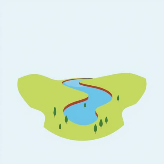
Diagram Of Meander And Oxbow Lake
Rivers are dynamic systems that shape the landscape over time, creating unique features that reflect the flow of water and the movement of sediments. Among these features, meanders and oxbow lakes are some of the most fascinating. They not only illustrate the power of erosion and deposition but also provide insight into the natural processes that continuously reshape river valleys. Understanding how these formations occur helps in studying river dynamics, floodplain development, and environmental management. Diagrams of meanders and oxbow lakes are essential tools in geography and earth science, helping students, researchers, and enthusiasts visualize the processes behind these landforms.
What is a Meander?
A meander is a winding curve or bend in a river, often forming in the middle and lower courses of the river where the gradient is gentle. Meanders develop because of the lateral erosion and deposition along the riverbanks. As water flows through a river, it does not move in a straight line but swirls and bends due to variations in velocity. On the outer side of the bend, where water flows faster, erosion occurs, creating a river cliff. On the inner side, where water flows more slowly, deposition takes place, forming a gentle slope called a slip-off slope.
Formation of Meanders
- Initial irregularity Small bends in the river may start due to obstacles or variations in soil resistance.
- Lateral erosion Faster water erodes the outer bank of bends, deepening the curve.
- Deposition Slower water on the inner bank deposits sediments, gradually exaggerating the bend.
- Continued migration Over time, meanders become more pronounced as erosion and deposition continue.
Meanders are not static. They shift over time, gradually moving across the floodplain. This movement contributes to the formation of fertile soil and creates a rich habitat for plants and animals along the riverbanks. Diagrammatic representations of meanders show the alternating pattern of erosion and deposition, highlighting the continuous cycle of river dynamics.
Understanding Oxbow Lakes
An oxbow lake is a U-shaped water body formed when a meander is cut off from the main river channel. These lakes are typical in mature river landscapes where meanders have become extremely curved. The formation of oxbow lakes is closely linked to the natural process of meander evolution, illustrating the river’s tendency to take a shorter, more efficient course over time.
Formation Process of Oxbow Lakes
- Exaggeration of meander Continuous erosion on the outer banks and deposition on inner banks increases the curve of the meander.
- Neck formation The bends of a meander move closer together, forming a narrow land strip called the meander neck.
- Cut-off event During floods or high river flow, the river may break through the neck, creating a new, straighter channel.
- Lake formation The abandoned bend becomes isolated from the main river, forming an oxbow lake.
Oxbow lakes vary in size and shape depending on the river’s characteristics and the surrounding landscape. Over time, some oxbow lakes may fill with sediments and vegetation, turning into wetlands or marshes. Diagrams of oxbow lakes clearly show the original river course, the cut-off point, and the resulting water body, making it easier to understand the transformation from meander to oxbow lake.
Importance of Diagrams in Understanding Meanders and Oxbow Lakes
Diagrams play a crucial role in explaining how meanders and oxbow lakes develop. They simplify complex natural processes, allowing students and researchers to visualize the stages of formation. Key elements often highlighted in diagrams include erosion zones, deposition zones, river cliffs, slip-off slopes, and the cut-off process that leads to oxbow lakes. Using diagrams alongside descriptive explanations enhances comprehension and provides a practical tool for studying river landscapes.
Applications in Geography and Environmental Studies
- Education Diagrams help students grasp the concepts of river dynamics, erosion, and deposition.
- Environmental management Understanding meander migration and oxbow lake formation aids in flood control and riverbank management.
- Habitat conservation Oxbow lakes serve as habitats for diverse species, and studying their formation supports biodiversity conservation.
- Urban planning Knowledge of meander evolution can prevent construction in flood-prone areas.
Key Features to Include in a Diagram
When drawing or studying diagrams of meanders and oxbow lakes, it is important to highlight the following features
- The main river channel, showing the flow direction.
- Curves or bends indicating meanders.
- Erosion zones on the outer banks.
- Deposition zones on the inner banks.
- Meander neck and the cut-off point for oxbow lakes.
- The isolated water body representing the oxbow lake.
- Vegetation or sediment deposition if needed for context.
Meanders and oxbow lakes are essential components of river landscapes, showcasing the dynamic nature of flowing water. Diagrams of these features provide a clear visual representation of complex processes like erosion, deposition, and river migration. Understanding these formations helps in education, environmental management, and ecological conservation. By studying diagrams, one can appreciate not only the beauty of rivers but also the underlying forces that continuously shape our natural environment. Knowledge of meanders and oxbow lakes offers valuable insights into river behavior, floodplain development, and the intricate balance between land and water.
In summary, diagrams of meanders and oxbow lakes are powerful tools for learning about river systems. They illustrate how water continuously sculpts the earth, forming curves, cutting off channels, and creating isolated lakes. By combining visual aids with descriptive explanations, anyone can understand the processes that give rise to these remarkable landforms and their significance in geography and ecology.