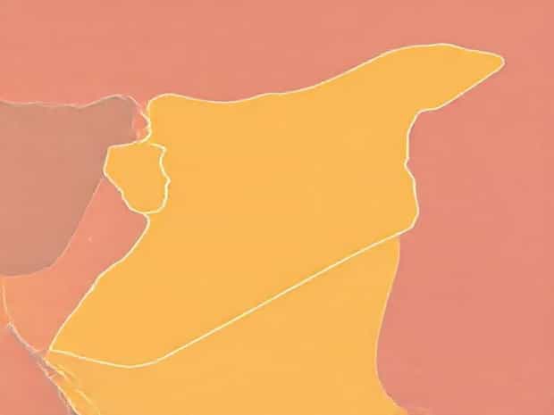
Map Of Syria And Israel
The geographical proximity of Syria and Israel has played a pivotal role in shaping the history, politics, and culture of the Middle East. Understanding the map of Syria and Israel is essential for comprehending the complex interactions between these nations, including border disputes, trade routes, strategic military locations, and cultural exchanges. The map highlights the intricate geography that influences both natural resources and human settlements, while also offering insights into the historical context of the region.
Geographical Overview of Syria
Syria is located in the Levant region of Western Asia, bordered by Turkey to the north, Iraq to the east, Jordan to the south, and Israel and Lebanon to the southwest. The country spans approximately 185,180 square kilometers, featuring diverse terrain that ranges from fertile plains in the west to arid deserts in the east. The western part of Syria includes the Syrian Coastal Mountain Range, which stretches parallel to the Mediterranean Sea, offering a temperate climate and fertile lands suitable for agriculture.
Key Cities and Regions in Syria
- DamascusThe capital city, located in southwestern Syria, is one of the oldest continuously inhabited cities in the world. It serves as the political, cultural, and economic hub of the country.
- AleppoSituated in the north, Aleppo has historically been a major commercial center and a strategic location near the Turkish border.
- Homs and HamaBoth cities are situated along the Orontes River, facilitating agriculture and trade throughout history.
- Deir ez-ZorLocated in the eastern desert, it is a key site near the Euphrates River and plays a role in energy production and transport.
Geographical Overview of Israel
Israel is situated along the eastern coast of the Mediterranean Sea, sharing borders with Lebanon to the north, Syria to the northeast, Jordan to the east, and Egypt to the southwest. Covering approximately 20,770 square kilometers, Israel features a variety of geographical landscapes, including coastal plains, mountain ranges, the Jordan Rift Valley, and the Negev Desert in the south. The country’s location at the crossroads of Africa and Asia makes it strategically significant for trade, military, and cultural connections.
Key Cities and Regions in Israel
- JerusalemThe capital city, known for its historical and religious significance to Judaism, Christianity, and Islam, lies in the Judaean Mountains.
- Tel AvivA modern metropolitan area along the Mediterranean coast, known as Israel’s economic and technological hub.
- HaifaLocated in the north, Haifa is a major port city that facilitates trade and industry.
- EilatSituated in the southern tip of Israel, Eilat serves as a gateway to the Red Sea and an important center for tourism and maritime trade.
Shared Borders and Geopolitical Significance
The border between Syria and Israel is approximately 76 kilometers long, running along the Golan Heights, a strategically significant plateau. The Golan Heights provides a vantage point over northern Israel and southern Syria, making it crucial for military and security purposes. The region has been a focal point of conflict, especially during the Six-Day War in 1967, after which Israel occupied a portion of the Golan Heights. Understanding the map of Syria and Israel highlights the importance of natural terrain in shaping military strategies and geopolitical relations.
Strategic Locations and Conflicts
- Golan HeightsElevated terrain that provides control over surrounding areas and access to water resources, including the Sea of Galilee.
- Yarmouk RiverA shared water resource forming part of the border, vital for agriculture and local communities.
- QuneitraA city within the Golan Heights region, affected by historical conflicts and now serving as a symbol of contested borders.
- Demilitarized ZonesEstablished through various peace agreements, these zones are marked on maps to prevent military escalation.
Natural Features Influencing Human Settlement
The maps of Syria and Israel reveal several natural features that influence population distribution and urban development. The Jordan River valley provides fertile land and water resources, supporting agriculture and settlements. Similarly, the Mediterranean coastal plains in both countries offer favorable climates for cities, trade ports, and industrial centers. Desert areas, such as the Syrian Desert and Israel’s Negev, are sparsely populated but hold strategic and ecological significance.
Water Resources
- Jordan RiverA vital water source flowing from the Sea of Galilee to the Dead Sea, forming part of the international border.
- Orontes RiverRuns through western Syria, supporting agriculture and settlements near Homs and Hama.
- Lake Tiberias (Sea of Galilee)An essential freshwater source for Israel, located near the Golan Heights.
Economic and Cultural Implications of Geography
The geographic layout of Syria and Israel, as seen on their maps, has direct implications on trade, agriculture, and cultural interactions. Coastal regions foster trade and port cities, while river valleys sustain agriculture and human settlements. The Golan Heights, elevated terrains, and border zones affect political and military strategies. Additionally, historical trade routes connecting the Levant, Mesopotamia, and Mediterranean regions have influenced cultural exchanges and demographic patterns over centuries.
Transportation and Trade Routes
- Major highways and railways link key cities like Damascus, Aleppo, Tel Aviv, and Jerusalem, facilitating commerce and mobility.
- Ports in Haifa and along the Mediterranean coast enable international trade, contributing to economic growth.
- Border crossings between Syria and Israel are limited and heavily monitored due to security concerns.
Understanding the map of Syria and Israel is crucial for comprehending the geographical, political, and cultural dynamics of the region. From the strategic Golan Heights to the fertile Jordan River valley and Mediterranean coastal plains, the geography shapes human settlements, resource management, and historical conflicts. Accurate maps not only provide insights into the physical terrain but also offer a framework to understand border disputes, trade networks, and regional security considerations. The interplay between natural features and human activities continues to define the complex relationship between Syria and Israel, making geographic knowledge an essential tool for policymakers, historians, and travelers alike.