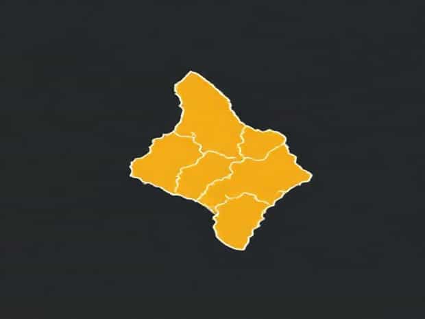
Map Of Congo Brazzaville
The map of Congo Brazzaville, officially known as the Republic of the Congo, provides an essential tool for understanding the geography, political divisions, natural resources, and cultural landmarks of this Central African nation. As one explores the map, it becomes clear how rivers, mountains, and forests shape the life and development of the country. The Congo River, one of the largest rivers in Africa, dominates the landscape and serves as a vital transportation route connecting remote regions. Cities, provinces, and natural parks are all marked on the map, offering insights into the demographic and economic distribution across the country. For travelers, researchers, and students, studying the map of Congo Brazzaville provides a foundational understanding of its spatial structure and its place within Africa.
Geographical Overview
Congo Brazzaville is located in Central Africa, bordered by Gabon to the west, Cameroon and the Central African Republic to the north, the Democratic Republic of the Congo to the east and south, and the Atlantic Ocean to the southwest. The map highlights the country’s diverse topography, including plateaus, lowland forests, and river valleys. The Congo River runs along its southern border, separating it from the larger Democratic Republic of the Congo. This river is central to the nation’s economy, transportation, and agriculture. Other rivers such as the Sangha and the Kouilou also feature prominently on detailed maps, serving as lifelines for local communities.
Administrative Divisions
The map of Congo Brazzaville shows its division into twelve departments, each with unique cultural and geographic characteristics. The capital city, Brazzaville, is located on the southern border, directly across the Congo River from Kinshasa. Other significant departments include Pointe-Noire, home to the country’s main port and oil industry, and Likouala, characterized by dense rainforests and wetlands. Maps often mark provincial capitals, major highways, and secondary roads, which are essential for understanding how people and goods move across the country.
Major Cities and Towns
- BrazzavilleThe political and administrative capital, located on the Congo River, featuring government buildings, cultural institutions, and historical landmarks.
- Pointe-NoireThe economic hub and largest port city, known for oil extraction, trade, and industrial development.
- OwandoA key regional center in the north, surrounded by forests and natural reserves.
- DolisieAn important transport and commercial center, connecting southern departments via rail and road networks.
Natural Features on the Map
The Republic of the Congo is rich in natural landscapes, all clearly represented on maps. Tropical rainforests cover a significant portion of the country, particularly in the north and central regions. These forests are home to diverse wildlife, including gorillas, elephants, and a variety of bird species. National parks and nature reserves, such as Odzala-Kokoua National Park, are often highlighted on maps to show areas of ecological importance. The coastal plain along the Atlantic Ocean provides mangrove swamps and fishing grounds, while the plateaus and hills in the interior are crucial for agriculture and settlement.
Transportation Networks
Maps of Congo Brazzaville also emphasize the transportation infrastructure, which is vital given the country’s challenging terrain. Major highways connect key cities, though many secondary roads are unpaved or limited in accessibility during the rainy season. Railways, including the Congo-Ocean Railway, link Brazzaville with Pointe-Noire and facilitate trade and travel. River transport remains essential for communities along the Congo and Sangha rivers, providing access to remote villages where roads are scarce.
Economic and Resource Distribution
The map can also serve as a guide to the economic landscape of Congo Brazzaville. Oil extraction near Pointe-Noire and along the coastal shelf drives much of the national economy. Mineral resources, including copper, diamonds, and potash, are located in specific regions and are often indicated on thematic maps. Agricultural areas are marked, showing zones of cassava, maize, and banana cultivation. Understanding the spatial distribution of resources helps in analyzing economic opportunities and challenges within the country.
Tourism and Cultural Sites
- Lefini ReserveKnown for its wildlife and natural scenery, accessible through maps that show major river routes.
- Conkouati-Douli National ParkA coastal park with rich biodiversity and pristine beaches.
- Historical Landmarks in BrazzavilleMuseums, colonial-era buildings, and monuments are often marked to guide tourists and researchers.
Using Maps for Education and Planning
Maps of Congo Brazzaville are not only useful for travelers and tourists but are also crucial for education, government planning, and scientific research. Schools use maps to teach students about geography, culture, and history. Government agencies rely on detailed maps for infrastructure development, resource management, and emergency planning. Environmental organizations use maps to monitor deforestation, wildlife migration, and water resources. Accurate maps provide a spatial understanding that allows for informed decision-making across multiple sectors.
Challenges in Mapping
While maps offer a wealth of information, there are challenges in representing Congo Brazzaville accurately. Dense forests, seasonal rivers, and remote regions can make mapping difficult. Updates are required to reflect changes in infrastructure, population centers, and natural resource exploitation. Digital maps and satellite imagery have improved accuracy, but ground verification remains essential for reliable geographic information.
The map of Congo Brazzaville offers more than a simple visual representation; it provides a comprehensive insight into the country’s geography, administrative structure, natural resources, and human activities. From the bustling streets of Brazzaville to the dense rainforests of the north, the map tells a story of diversity, resilience, and opportunity. By studying these maps, individuals gain a deeper understanding of the Republic of the Congo’s unique position within Africa and the challenges and potentials that shape its development. Whether for education, travel, or research, the map remains an indispensable tool for exploring this vibrant and complex nation.