Latitude And Longitude Are Measured In
Latitude and longitude are fundamental concepts in geography and navigation, allowing us to pinpoint any location on the Earth’s surface with precision. These measurements are essential for mapping, GPS technology, aviation, marine navigation, and scientific research. Understanding how latitude and longitude are measured, the units used, and their practical applications helps people from students to professionals navigate the world accurately. The use of these coordinates provides a universal system that transcends languages and borders, making global positioning both standardized and reliable.
Understanding Latitude
Latitude refers to the angular distance of a location north or south of the Equator, which is designated as 0 degrees latitude. Lines of latitude, also called parallels, run horizontally around the Earth and are measured in degrees, minutes, and seconds. The measurement ranges from 0° at the Equator to 90° at the poles. For example, the North Pole is located at 90°N, while the South Pole is at 90°S. Latitude plays a critical role in determining climate zones, time zones, and navigation routes.
Units Used to Measure Latitude
Latitude is measured in degrees (°), minutes (‘), and seconds (). One degree is divided into 60 minutes, and each minute is further divided into 60 seconds. For instance, a location might be described as 34° 15’ 30″ N, indicating 34 degrees, 15 minutes, and 30 seconds north of the Equator. In modern technology, latitude is often expressed in decimal degrees for simplicity, such as 34.2583° N. This system allows for extremely precise positioning, useful for GPS devices, scientific studies, and mapping applications.
Understanding Longitude
Longitude measures the angular distance of a location east or west of the Prime Meridian, which passes through Greenwich, England, and is defined as 0° longitude. Lines of longitude, or meridians, run vertically from the North Pole to the South Pole, converging at the poles. Longitude values range from 0° at the Prime Meridian to 180° east or west. Unlike latitude, longitude directly influences time measurement, as the Earth’s rotation means each degree of longitude represents a change in local time.
Units Used to Measure Longitude
Longitude, like latitude, is measured in degrees (°), minutes (‘), and seconds (“). Each degree of longitude is divided into 60 minutes, and each minute into 60 seconds. For example, a location might be noted as 77° 36’ 30” E, indicating 77 degrees, 36 minutes, and 30 seconds east of the Prime Meridian. Decimal degrees are also commonly used in digital maps and GPS systems. Accurate longitude measurement is crucial for navigation, aviation, and determining global time zones.
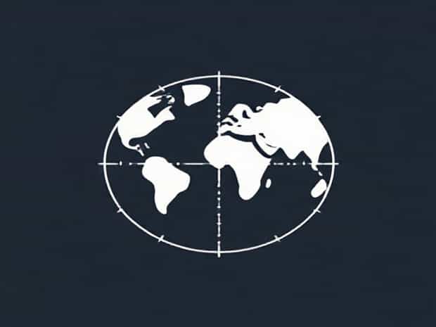
The Coordinate System
The combination of latitude and longitude forms a geographic coordinate system that uniquely identifies any location on Earth. The intersection of a specific latitude and longitude line provides a precise point. For example, New York City is located approximately at 40.7128° N latitude and 74.0060° W longitude. This coordinate system is widely used in mapping, navigation, and satellite technologies, ensuring consistency across different countries and disciplines.
Practical Applications of Latitude and Longitude
Latitude and longitude measurements are used in a variety of fields. In aviation, pilots rely on precise coordinates to navigate flight paths. Mariners use these measurements to plot sea routes safely. GPS technology, which underpins navigation in cars, smartphones, and outdoor devices, depends entirely on latitude and longitude. Scientists use coordinates for field research, environmental monitoring, and geological surveys. Emergency services also rely on accurate location data for rapid response and disaster management.
Latitude and Longitude in Modern Technology
Advancements in technology have made the use of latitude and longitude more accessible than ever. GPS satellites transmit signals that allow devices to calculate precise coordinates anywhere on Earth. Mapping software, online platforms, and mobile applications use these measurements to provide real-time navigation, route planning, and location-based services. The decimal degree system simplifies calculations and integration with computer systems, while still maintaining accuracy for scientific and commercial purposes.
Importance in Cartography
Cartography, the science of map-making, relies heavily on latitude and longitude. Maps use a grid system based on these coordinates to represent locations accurately. Latitude lines help determine horizontal positioning, while longitude lines help with vertical positioning. By combining these measurements, cartographers can create detailed maps for geographic analysis, navigation, and urban planning. This coordinate system ensures that maps are standardized and universally understandable, facilitating international cooperation and travel.
Challenges in Measurement
While latitude and longitude provide precise location data, there are challenges in measurement. The Earth is not a perfect sphere but an oblate spheroid, causing minor variations in calculations. Early explorers and scientists had to rely on celestial observations to determine their position, which could be inaccurate. Today, modern technology, such as atomic clocks, satellites, and digital mapping tools, allows for highly accurate measurements, overcoming many of the limitations faced in historical navigation.
Latitude, Longitude, and Global Positioning Systems
Global Positioning Systems (GPS) are the most common application of latitude and longitude today. GPS devices use signals from multiple satellites to triangulate a precise location on Earth. Latitude and longitude are the basis for this system, allowing devices to calculate position within meters or even centimeters. This has revolutionized navigation, logistics, agriculture, surveying, and many other fields, making the accurate measurement of coordinates essential in the modern world.
Summary of Key Points
- Latitude measures distance north or south of the Equator, while longitude measures distance east or west of the Prime Meridian.
- Both latitude and longitude are measured in degrees, minutes, and seconds, or in decimal degrees.
- The combination of latitude and longitude forms a coordinate system that can identify any location on Earth.
- Latitude influences climate zones, while longitude is closely tied to time measurement.
- Modern applications include GPS, mapping, navigation, aviation, and scientific research.
- Accurate measurement relies on technology such as satellites, atomic clocks, and digital mapping software.
- The coordinate system is essential for global navigation, disaster management, and location-based services.
Latitude and longitude are essential for understanding and navigating the Earth. Measured in degrees, minutes, and seconds or decimal degrees, these coordinates provide a universal system for identifying any point on the planet. From historical navigation to modern GPS technology, the accurate measurement of latitude and longitude enables precise mapping, global positioning, and real-time navigation. This system is fundamental to geography, science, travel, and everyday technology, demonstrating the importance of understanding how latitude and longitude are measured and applied in the modern world.