Geography Physiography And Drainage
Geography, physiography, and drainage are fundamental concepts that help us understand the physical characteristics of the Earth’s surface and how water moves across it. Geography provides a broad perspective of landforms, climate, and human interaction, while physiography focuses specifically on the natural physical features of the landscape, including mountains, plateaus, plains, and valleys. Drainage, on the other hand, examines the patterns of rivers, streams, and other watercourses that shape the terrain and influence ecosystems, agriculture, and human settlements. Together, these elements form the foundation for understanding natural environments and their interactions with human activities, offering insights into resource management, urban planning, and environmental conservation.
Geography The Study of Earth’s Surface
Geography is the scientific study of the Earth, its features, and the relationships between people and their environment. It encompasses both physical geography, which examines natural processes and landforms, and human geography, which focuses on population, culture, and economic activities. Physical geography provides the basis for understanding physiography and drainage, as it examines the distribution of mountains, plains, rivers, and climate patterns. By analyzing geographic factors, researchers can predict natural hazards, plan land use, and manage natural resources effectively.
Key Components of Geography
- Landforms such as mountains, valleys, plateaus, and plains.
- Climate and weather patterns that influence vegetation and human activities.
- Natural resources including soil, minerals, water, and forests.
- Human interaction with the environment, including urbanization and agriculture.
Physiography Understanding Landforms
Physiography is a branch of physical geography that deals with the study of landforms and the processes that shape them. It involves examining the structure, relief, and evolution of the Earth’s surface. Physiographic studies classify regions based on elevation, slope, and geological features, which helps in understanding natural landscapes. Mountains, plateaus, plains, and coastal regions are primary physiographic units, each with unique characteristics that influence climate, vegetation, and human settlement patterns. By analyzing physiography, geographers and planners can assess land suitability for agriculture, construction, and other activities.
Major Physiographic Units
- MountainsElevated areas with steep slopes formed by tectonic activity or volcanic processes.
- PlateausFlat or gently sloping elevated regions often created by volcanic or tectonic uplift.
- PlainsExtensive low-lying areas that are ideal for agriculture and settlement.
- ValleysDepressions between mountains or hills formed by rivers or glacial activity.
- Coastal RegionsAreas influenced by the sea, including beaches, cliffs, and deltas.
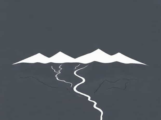
Drainage Systems and Patterns
Drainage refers to the network of rivers, streams, and other water bodies that remove excess water from the land. The study of drainage is essential for understanding hydrological processes, soil erosion, and water resource management. Drainage systems influence agriculture, human settlements, and ecological balance. The patterns formed by rivers depend on topography, geology, and climate, and they play a crucial role in shaping physiographic features over time. Efficient drainage management is also vital for preventing floods, conserving water, and maintaining soil fertility.
Types of Drainage Patterns
- DendriticTree-like branching pattern, typical of regions with uniform rock structures.
- RadialRivers radiate from a central high point, often seen around volcanoes or domes.
- RectangularStreams follow jointed or faulted rocks, forming a network of right-angled tributaries.
- TreillisRivers follow alternating bands of resistant and soft rocks, common in folded mountain regions.
- DerangedIrregular patterns with lakes and swamps, typical of recently glaciated areas.
Relationship Between Geography, Physiography, and Drainage
Geography, physiography, and drainage are interrelated fields that provide a comprehensive understanding of the Earth’s surface. The physiographic features of a region, such as mountains, plateaus, and plains, directly influence the drainage pattern and water flow. For example, rivers originating in mountains often have steep gradients and fast-flowing streams, while rivers in plains exhibit meandering courses. Similarly, geography considers the impact of climate and human activities on these natural processes. Together, these disciplines help predict environmental changes, manage natural hazards, and plan sustainable development.
Impact on Human Activities
- Agriculture Drainage and physiography determine soil fertility and irrigation potential.
- Urban Planning Geography and landforms guide the construction of cities, roads, and infrastructure.
- Flood Management Understanding drainage patterns helps prevent flood damage and design drainage systems.
- Resource Utilization Rivers and landforms influence mining, forestry, and water resource management.
Significance in Environmental Studies
Studying geography, physiography, and drainage is essential for environmental research and conservation. These fields provide insights into soil erosion, sediment transport, water availability, and ecosystem health. Conservation strategies for rivers, wetlands, and forests rely on a deep understanding of these natural systems. Moreover, analyzing drainage patterns and landforms helps assess the impact of climate change, urbanization, and deforestation on landscapes. By integrating these studies, environmentalists and policymakers can implement sustainable practices that protect both human and natural communities.
Applications in Environmental Management
- Watershed management for sustainable water supply and flood prevention.
- Soil conservation in agricultural and deforested areas.
- Urban planning to reduce environmental degradation and pollution.
- Ecological restoration of rivers, wetlands, and degraded landscapes.
Geography, physiography, and drainage together form the foundation for understanding the Earth’s physical environment. Geography provides a broad view of land, climate, and human interaction, physiography examines the detailed characteristics of landforms, and drainage studies reveal how water shapes landscapes and supports life. These fields are essential for environmental management, urban planning, disaster mitigation, and resource utilization. By studying and integrating these disciplines, scientists, planners, and policymakers can make informed decisions to maintain ecological balance, promote sustainable development, and enhance the quality of life for communities worldwide.