Map Of Israel And Surrounding Countries
Israel is a small but geopolitically significant country located in the Middle East, bordered by several countries and bodies of water that shape its geography and strategic importance. Understanding the map of Israel and its surrounding countries is essential for comprehending regional politics, trade routes, cultural interactions, and historical conflicts. Israel’s location connects it to both the Mediterranean region and the Arabian Peninsula, influencing climate, natural resources, and population distribution. Its borders have been shaped by historical events, treaties, and conflicts, making the study of Israel’s geography and neighboring nations critical for both scholars and travelers.
Geographic Location of Israel
Israel is situated on the southeastern shore of the Mediterranean Sea. Its geographic coordinates place it between approximately 29° and 33° North latitude and 34° and 36° East longitude. Despite its relatively small size of about 22,000 square kilometers, Israel features a diverse landscape that includes coastal plains, mountain ranges, valleys, deserts, and freshwater bodies such as the Sea of Galilee. The country’s compact size allows for significant geographic diversity, from the fertile regions of the north to the arid Negev Desert in the south.
Israel’s Borders and Neighboring Countries
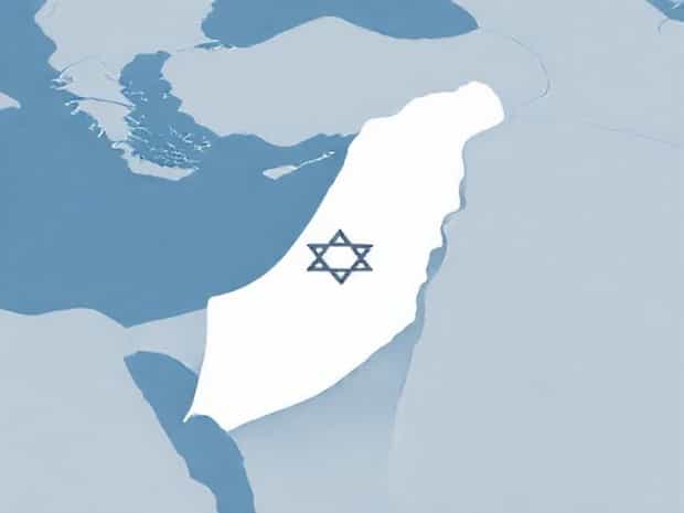
Israel shares borders with several countries, each with its own geopolitical and cultural significance. To the north, Israel is bordered by Lebanon, with a boundary that runs through mountainous regions and valleys. This northern border has been historically sensitive due to conflicts and political tensions. To the northeast, Israel shares a short border with Syria, primarily along the Golan Heights. To the east, Israel is bordered by Jordan, with the Jordan River and the Dead Sea forming natural boundaries. To the southwest, Israel borders Egypt, with the Sinai Peninsula forming a strategic geographic buffer. The Mediterranean Sea lies to the west, providing access to maritime trade and influencing climate patterns.
- North Lebanon
- Northeast Syria (Golan Heights region)
- East Jordan (with the Jordan River and Dead Sea)
- Southwest Egypt (Sinai Peninsula)
- West Mediterranean Sea
Key Geographic Features
The map of Israel reveals several geographic features that define its landscape and human settlement patterns. The coastal plain along the Mediterranean Sea supports major cities such as Tel Aviv, Haifa, and Ashdod, which are hubs for commerce, industry, and tourism. The central highlands, including the mountains of Jerusalem, create a natural barrier between coastal and inland regions. The Jordan Rift Valley, formed by tectonic activity, runs along the eastern border and includes the Jordan River and the Dead Sea, the lowest point on Earth’s land surface. The Negev Desert covers much of southern Israel, characterized by arid terrain and unique geological formations.
Strategic Importance of Israel’s Geography
Israel’s location at the crossroads of Africa, Asia, and Europe gives it strategic significance in both historical and modern contexts. The country’s access to the Mediterranean Sea enables maritime trade and military defense, while its borders with neighboring countries influence security considerations and regional diplomacy. Mountainous regions, river valleys, and desert terrain have shaped military strategies and settlement patterns throughout history. The map of Israel highlights the importance of geographic features in terms of water resources, agricultural potential, and urban development, emphasizing how location impacts national policy and regional relations.
Neighboring Countries and Regional Context
Understanding Israel’s surrounding countries provides insight into its geopolitical environment and regional dynamics. Lebanon to the north features coastal plains and mountain ranges, and has historically experienced conflict that has affected Israel’s northern border security. Syria to the northeast, particularly the Golan Heights, is strategically important for water resources and military advantage. Jordan to the east shares cultural and economic ties with Israel, and the Jordan River serves as a critical freshwater resource. Egypt to the southwest, with the Sinai Peninsula, has been both a trade route and a historical buffer region. The surrounding countries, together with Israel, form a complex network of historical, cultural, and economic relationships.
Major Cities Near Borders
- Haifa and Nahariya near the northern border with Lebanon
- Jerusalem and Quneitra near the northeastern Golan Heights border
- Beersheba and Eilat near the southern desert region and Egypt
- Amman in Jordan across the eastern border
Water Bodies and Coastal Access
Israel’s map shows its access to several key water bodies, which are crucial for both the environment and human activity. The Mediterranean Sea to the west provides Israel with ports for international trade, fishing, and recreational activities. The Sea of Galilee in the north serves as a major freshwater source and supports agriculture and tourism. The Jordan River flows from the Sea of Galilee southward into the Dead Sea, creating fertile areas along its banks and forming a natural boundary with Jordan. The Dead Sea, known for its high salinity and mineral-rich waters, is a significant tourist attraction and natural landmark. These water bodies highlight the importance of Israel’s geography in sustaining life, trade, and cultural heritage.
Climate Influence
Israel’s climate is heavily influenced by its geography and surrounding countries. The coastal regions enjoy a Mediterranean climate with mild, wet winters and hot, dry summers. Inland and elevated areas, such as Jerusalem, experience more temperate conditions, while southern regions like the Negev Desert are arid. The proximity to the Mediterranean Sea moderates temperatures, while desert and mountain regions create microclimates. This geographic diversity allows for a variety of agricultural practices and human settlement patterns across the country.
Political and Cultural Significance
The map of Israel and its surrounding countries also highlights the political and cultural importance of its location. Israel’s borders are central to historical and ongoing conflicts, peace treaties, and diplomatic relations. The proximity to Lebanon, Syria, Jordan, and Egypt shapes its security policies and international relations. Cultural and religious sites in Jerusalem, Bethlehem, and other areas have global significance, attracting pilgrims, tourists, and scholars. Understanding the map of Israel helps contextualize its geopolitical challenges and its role as a cultural and religious center in the Middle East.
Tourism and International Access
- Mediterranean coastal cities attract tourists and provide trade access.
- Historic and religious sites in Jerusalem and Bethlehem draw international visitors.
- Border proximity facilitates cross-border trade and cultural exchange with neighboring countries.
- Ports such as Haifa and Ashdod enhance global maritime connectivity.
The map of Israel and its surrounding countries reveals a geographically diverse and strategically significant region. Israel’s borders with Lebanon, Syria, Jordan, and Egypt, along with its Mediterranean coastline, create a landscape of political, economic, and cultural importance. Its geographic features, including mountains, valleys, rivers, and deserts, influence settlement patterns, agriculture, and tourism. The surrounding countries contribute to regional dynamics, trade, and historical relationships that have shaped Israel’s development and security policies. By understanding Israel’s location and its neighboring countries, one can better appreciate the complexity of the region and the factors that impact its people, economy, and international significance.
In summary, Israel’s map is not just a depiction of borders and landforms; it is a reflection of centuries of history, culture, and strategic importance. Its location in the Middle East, surrounded by key countries and diverse geographic features, makes it a central player in regional politics, trade, and cultural heritage. The map helps contextualize Israel’s role in the world and provides insights into the natural and human-made factors that continue to shape this unique country.