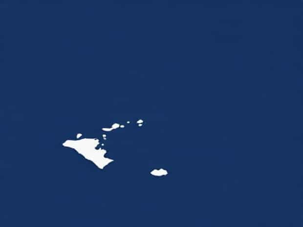
Map Of Bay Of Biscay
The Bay of Biscay is a large gulf of the northeast Atlantic Ocean, located along the western coast of France and the northern coast of Spain. Known for its dramatic weather, deep waters, and rich maritime history, the Bay of Biscay has been a significant region for sailors, traders, and explorers for centuries. Its coastline features a mix of rugged cliffs, sandy beaches, and important port cities that have shaped the economic and cultural development of both France and Spain. Understanding the geography and features of the Bay of Biscay through a detailed map provides insight into the natural environment, marine routes, and coastal communities that thrive in this part of Europe. The bay is also notable for its ecological diversity, supporting numerous species of fish, seabirds, and marine mammals, making it a critical area for environmental studies and maritime conservation efforts.
Geographical Location of the Bay of Biscay
The Bay of Biscay stretches from the northern coast of Spain to the western coast of France. It is bordered by the Spanish regions of Galicia, Asturias, Cantabria, and the French regions of Nouvelle-Aquitaine and Brittany. The bay opens into the Atlantic Ocean, providing a connection between the Iberian Peninsula and the larger oceanic routes. A map of the Bay of Biscay clearly shows its irregular coastline, with inlets, estuaries, and several important river mouths such as the Loire, Adour, and the Garonne. The bay’s coordinates roughly range from 43°N to 51°N latitude and 1°W to 9°W longitude, positioning it as a key area for both oceanic navigation and European coastal access.
Major Cities and Ports
Several important port cities line the Bay of Biscay, making it a hub for commerce and tourism. In France, notable cities include Bordeaux, La Rochelle, and Bayonne. Bordeaux, situated along the Garonne River, has historically been a major wine-exporting city and continues to play a vital role in maritime trade. La Rochelle is known for its historic harbor and maritime museums, attracting both tourists and shipping activity. On the Spanish side, cities such as Bilbao, Santander, and Gijón provide access to industrial and fishing activities. Bilbao, with its modern port infrastructure, serves as a crucial gateway for imports and exports, while Santander and Gijón are renowned for their cultural heritage and seaside attractions. A map highlights the strategic placement of these cities along the bay, illustrating the relationship between geography and economic development.
Physical Features of the Bay
The Bay of Biscay is characterized by a combination of deep waters, strong currents, and sometimes turbulent weather conditions. It is known for having some of the roughest seas in Europe, particularly during winter months, due to Atlantic storms that can create high waves and dangerous conditions for maritime navigation. Bathymetric maps show that the bay reaches depths of up to 4,000 meters in certain areas, with a gradual slope from the continental shelf to the deep ocean. The bay’s seabed includes underwater canyons and sediment deposits from major rivers, which contribute to nutrient-rich waters that support a diverse marine ecosystem.
Coastal Geography
- Rugged Cliffs Northern Spain and parts of France feature rocky cliffs that rise dramatically from the water, creating scenic landscapes and natural barriers.
- Sandy Beaches Several stretches along the bay are known for their sandy beaches, popular for tourism and recreational activities.
- Estuaries and River Mouths Major rivers such as the Loire, Adour, and Garonne form estuaries that are vital for marine life and coastal trade.
- Islands and Inlets The bay contains several small islands and sheltered inlets that offer protected areas for fishing and local communities.
Navigation and Maritime Importance
Historically, the Bay of Biscay has played a crucial role in maritime navigation. Its deep waters and strategic location have made it a key route for commercial shipping, naval operations, and fishing activities. Mariners rely on detailed nautical maps of the bay to navigate safely through its sometimes unpredictable waters. Ports along the bay provide safe harbor for vessels and serve as centers for shipbuilding, repair, and cargo transfer. Modern maps also indicate maritime boundaries, shipping lanes, and areas of ecological protection, ensuring that both commercial and environmental interests are balanced in the region.
Weather Patterns and Oceanography
The Bay of Biscay is notorious for its variable weather, which can change rapidly from calm to stormy conditions. Maps of the region often include information on prevailing winds, wave heights, and sea currents. Winter storms, driven by Atlantic depressions, can create waves exceeding 10 meters, while summer months tend to bring calmer seas and more predictable weather. Oceanographic studies of the bay show that the mixing of warm and cold currents contributes to a productive ecosystem, supporting fisheries that are vital to the local economy.
Ecological Significance
The Bay of Biscay is home to a rich variety of marine species, including dolphins, whales, seabirds, and commercially important fish. Maps and charts used in environmental research highlight areas of high biodiversity, marine protected zones, and migration routes for marine mammals. Conservation efforts are increasingly important due to overfishing, pollution, and climate change impacts. A comprehensive map can help scientists and policymakers identify critical habitats and manage the bay sustainably, ensuring the long-term health of both marine life and human communities that depend on these waters.
Tourism and Cultural Importance
Beyond its ecological and economic significance, the Bay of Biscay is a popular destination for tourism. Coastal towns offer cultural experiences, historical sites, and recreational activities such as boating, surfing, and hiking along scenic cliffs. A detailed map of the bay assists tourists in planning visits, identifying key landmarks, and understanding the geographical layout of the region. The map also reflects the blend of French and Spanish influences along the coastline, providing insight into the rich cultural heritage that has developed over centuries.
Understanding the Bay of Biscay through a detailed map reveals the complexity and richness of this Atlantic region. From its rugged coastline and deep waters to its bustling ports and diverse ecosystems, the bay plays a critical role in navigation, commerce, ecology, and culture. Maps not only guide mariners and tourists but also serve as tools for environmental management and scientific research. Whether studying the bay’s weather patterns, planning maritime routes, or exploring cultural landmarks, a comprehensive map provides an essential perspective on this iconic part of Europe’s Atlantic coast.