Gully And Rill Erosion
Gully and rill erosion are two significant forms of soil erosion that impact agricultural lands, natural landscapes, and ecosystems around the world. These processes occur when water runoff concentrates and moves over the soil surface, gradually removing soil ptopics and creating distinct channels. Understanding the causes, differences, and impacts of gully and rill erosion is crucial for effective soil conservation, land management, and environmental protection. Both types of erosion can lead to loss of fertile topsoil, reduced agricultural productivity, and increased sedimentation in rivers and reservoirs, highlighting the importance of implementing preventive measures to maintain soil health and landscape stability.
Definition of Rill Erosion
Rill erosion refers to the formation of small, narrow channels on the surface of the soil caused by the concentrated flow of water. These channels, known as rills, are usually a few centimeters deep and a few centimeters wide, making them relatively easy to manage if addressed early. Rill erosion typically occurs on sloping land during heavy rainfall or irrigation events, where water runoff gains enough velocity to detach and transport soil ptopics. While rills may seem minor, if left unchecked, they can expand and merge into larger gullies, exacerbating soil loss and land degradation.
Characteristics of Rill Erosion
- Shallow and narrow channels, typically a few centimeters deep and wide.
- Common on sloped farmland, pastures, and recently disturbed soil.
- Formed by concentrated water runoff, often during intense rain or irrigation.
- Can be repaired relatively easily through tillage or small-scale interventions.
- Potential precursor to gully erosion if not managed properly.
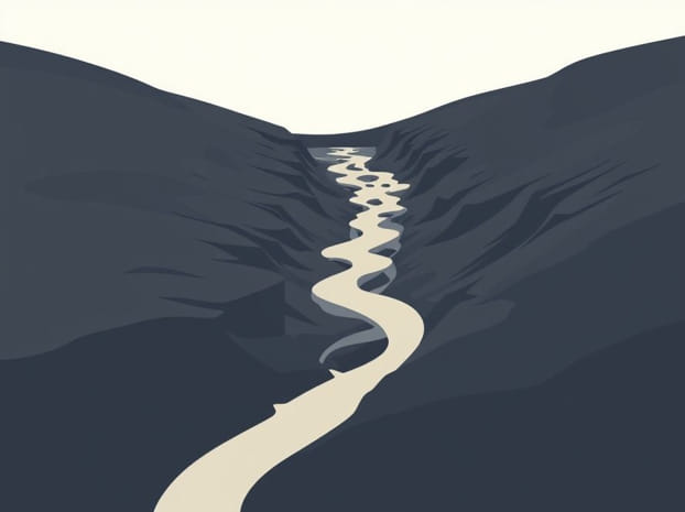
Definition of Gully Erosion
Gully erosion is a more severe form of soil erosion, where water runoff creates deep and wide channels that are difficult to traverse or cultivate. Unlike rills, gullies can be several meters deep and wide, often causing permanent changes to the landscape. Gully erosion occurs when water flow becomes highly concentrated, eroding the soil beyond the point where simple tillage can repair the damage. This form of erosion is commonly observed in regions with steep slopes, high rainfall intensity, or poorly managed agricultural land. Gullies not only reduce usable land but also increase sediment loads in streams and rivers, negatively impacting water quality and downstream ecosystems.
Characteristics of Gully Erosion
- Deep and wide channels, often several meters in size.
- Significant impact on land usability and agricultural productivity.
- Caused by concentrated water flow over prolonged periods or during intense storms.
- Often requires engineering solutions such as check dams, vegetation barriers, or reshaping to control.
- Can contribute to sedimentation and flooding in downstream areas.
Causes of Gully and Rill Erosion
Both gully and rill erosion are primarily caused by water runoff, but several factors influence their formation and severity. Rainfall intensity, soil type, slope gradient, vegetation cover, and land management practices all play critical roles in erosion processes. Areas with bare soil or weak vegetation cover are more susceptible, as the lack of protective layers allows water to dislodge and transport soil ptopics. Human activities, such as deforestation, overgrazing, and improper agricultural practices, can exacerbate erosion by reducing the soil’s structural stability and increasing runoff velocity.
Key Contributing Factors
- Heavy rainfall or rapid snowmelt increasing water flow and soil detachment.
- Steep slopes that accelerate runoff and erosion potential.
- Soil types prone to erosion, such as sandy or silty soils with low cohesion.
- Deforestation and overgrazing removing protective vegetation cover.
- Poor land management practices, including tillage along slopes and lack of contour farming.
Impacts on Agriculture and Environment
Rill and gully erosion have significant impacts on agricultural productivity and environmental sustainability. Soil loss from these processes reduces the availability of fertile topsoil, affecting crop yields and pasture quality. Erosion can also damage farm infrastructure, such as roads, fences, and irrigation systems, increasing maintenance costs for farmers. Beyond agriculture, sediment transported from eroded areas can enter rivers and reservoirs, leading to water pollution, sedimentation, and increased flood risk. Erosion also alters natural habitats, threatening plant and animal species, and can contribute to long-term land degradation if left unmanaged.
Consequences of Soil Erosion
- Loss of fertile topsoil, reducing agricultural productivity.
- Damage to farm infrastructure, including roads, drainage systems, and fences.
- Increased sedimentation in rivers, lakes, and reservoirs.
- Degradation of natural habitats and loss of biodiversity.
- Higher risk of downstream flooding due to altered water flow.
Prevention and Control Measures
Effective management of gully and rill erosion requires a combination of structural and vegetative measures. Preventive approaches include maintaining ground cover, planting grass or shrubs along slopes, and practicing contour farming to reduce runoff velocity. Terracing and constructing check dams in gullies can help slow water flow and trap sediments. Regular maintenance, such as filling rills with soil and reseeding vegetation, prevents small erosion features from developing into larger gullies. Integrating these strategies into land management plans ensures long-term soil conservation and landscape stability.
Control Techniques
- Vegetative Cover Planting grass, shrubs, or trees to protect soil from water impact.
- Contour Farming Plowing along natural land contours to reduce runoff velocity.
- Terracing Creating stepped fields on slopes to slow water flow.
- Check Dams Small barriers in gullies to trap sediments and reduce erosion.
- Rill Maintenance Filling and compacting rills to prevent development into larger gullies.
Monitoring and Assessment
Monitoring gully and rill erosion is essential for timely intervention and effective land management. Geographic Information Systems (GIS), remote sensing, and aerial photography are valuable tools for mapping erosion-prone areas, tracking changes over time, and planning control measures. Soil surveys and field assessments provide detailed information about soil properties, slope gradients, and vegetation cover, enabling targeted interventions. Regular monitoring ensures that erosion is detected early and that preventive and remedial measures are implemented effectively, minimizing long-term damage to agricultural and natural landscapes.
Monitoring Methods
- GIS Mapping Identifying erosion-prone areas and visualizing spatial patterns.
- Remote Sensing Using satellite imagery to detect changes in land cover and soil loss.
- Aerial Photography Capturing high-resolution images for detailed erosion assessment.
- Soil Surveys Evaluating soil type, structure, and susceptibility to erosion.
- Field Inspections On-site monitoring of rills and gullies for maintenance planning.
Gully and rill erosion are critical environmental issues that affect soil health, agricultural productivity, and ecosystem stability. Understanding the differences between these erosion types, their causes, and impacts is essential for effective land management and conservation practices. Implementing preventive measures such as vegetative cover, contour farming, terracing, and check dams, along with regular monitoring using GIS and field surveys, can significantly reduce soil loss and maintain landscape integrity. By addressing gully and rill erosion proactively, farmers, land managers, and policymakers can safeguard natural resources, promote sustainable agriculture, and protect the environment for future generations.